
3D Laser Scanning Services
We offer a variety of Point Cloud Mapping solutions for the AEC Industry. We specialize in 3D Laser scanning services for construction, real estate, and we serve property owners and property developers, interior designers and architects.
LiDAR Technology for As-Built Scans
Precision 3D Scanning revolutionizes the AEC industry with advanced 3D LiDAR scans. We empower architects, developers, and designers for transformative innovation.
Point Cloud Creation
Precision3DScanning offers comprehensive 3D LiDAR scanning services across various sectors. For the AEC industry, our services include AEC Site Scanning for detailed documentation, progress monitoring, and clash detection. We also provide Interior Scanning for high-resolution scans suitable for renovation, restoration, or facility management. Additionally, our Infrastructure Scanning covers bridges, tunnels, roads, and other structures for condition assessment and maintenance planning. Furthermore, we specialize in Point Cloud Development, offering Point Cloud Processing to generate accurate 3D models and digital twins, as well as Point Cloud Registration to seamlessly align multiple scans for complex structures.
- Scan to BIM Services
- Point Cloud Services
- 3D Point Cloud
- Digital Twins
- 3D Building Scanning
- LiDAR 3D Scanning
- Building Scanning Services
- LiDAR Digital Twins

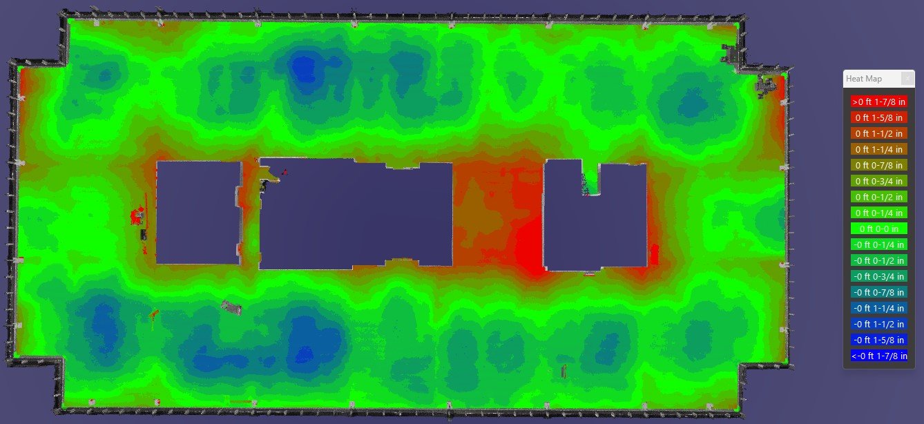
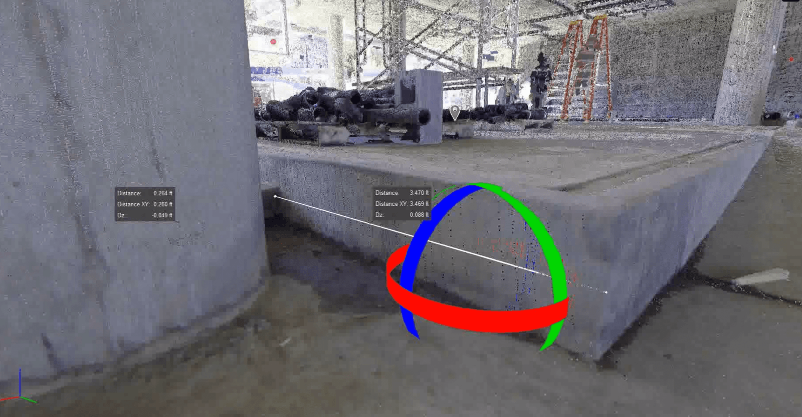
Concrete Elevation Heat Maps
In addition to our core services, Precision 3D Scanning offers Concrete Elevation Heat Maps, providing surface analysis to identify irregularities and defects, along with thickness mapping for precise measurement and visualization of concrete thickness. Moreover, our expertise extends to Data Analytics and Visualization, encompassing advanced data analysis techniques to derive meaningful insights from point cloud data. We also specialize in developing custom visualization tools and software for intuitive exploration and presentation of 3D data, ensuring seamless integration and interpretation of complex information.
- Floor Flatness
- Super Flat Concrete Floors
- Floor Flatness Testing Equipment
- F and F concrete
- FF Flooring
- FF/FL Reports
- FF FL
360 Degree High Resolution Photos
In addition to our advanced LiDAR scanning capabilities, our cutting-edge camera technology also captures high-resolution 360-degree images. This feature provides a comprehensive visual representation of your project, allowing for immersive exploration and detailed analysis. Whether you’re a property developer, owner, interior designer, or architect, our high-resolution imagery enhances project understanding and decision-making, ensuring every aspect is meticulously documented and effortlessly communicated. With Precision3DScanning, experience unparalleled clarity and detail in every angle, empowering you to visualize and execute your vision with confidence.
Custom Solutions and Integrations
Precision 3D Scanning offers comprehensive consulting and training services to enhance client capabilities in leveraging LiDAR technology. Our industry-specific consulting provides expert guidance on utilizing LiDAR within the AEC and concrete sectors, tailored to specific applications. Additionally, our training programs offer workshops and courses to educate clients on LiDAR scanning techniques, data processing workflows, and software tools.
We specialize in developing custom solutions to address unique challenges or requirements, ensuring tailored approaches to meet client needs. Furthermore, our integration services seamlessly integrate LiDAR scanning technology with existing workflows, systems, and software platforms utilized by clients, facilitating efficient and effective implementation.

Empower your next job with Precision 3D Scanning.
Get started by telling us about your next project.