Videos
-
Exploring My LiDAR Point Cloud of the Brick Obelisk Clock Tower
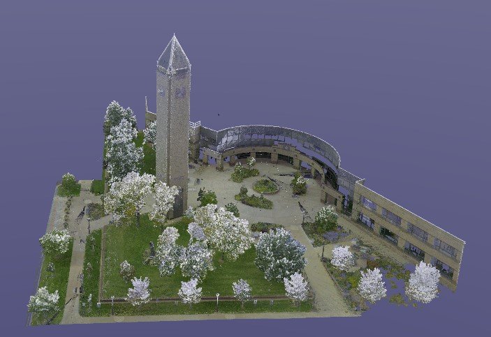
Exploring My LiDAR Point Cloud of the Brick Obelisk Clock Tower. I recently had the privilege of creating a detailed 3D point cloud of a stunning brick obelisk clock tower using LiDAR scanning. This project allowed me to capture every inch of the tower’s exterior and intricate features, preserving them in a digital format for…
-
Here we are using 3D Lidar Scanning for accurate measurements. A video of capturing field measurements from a point cloud 3D scan.
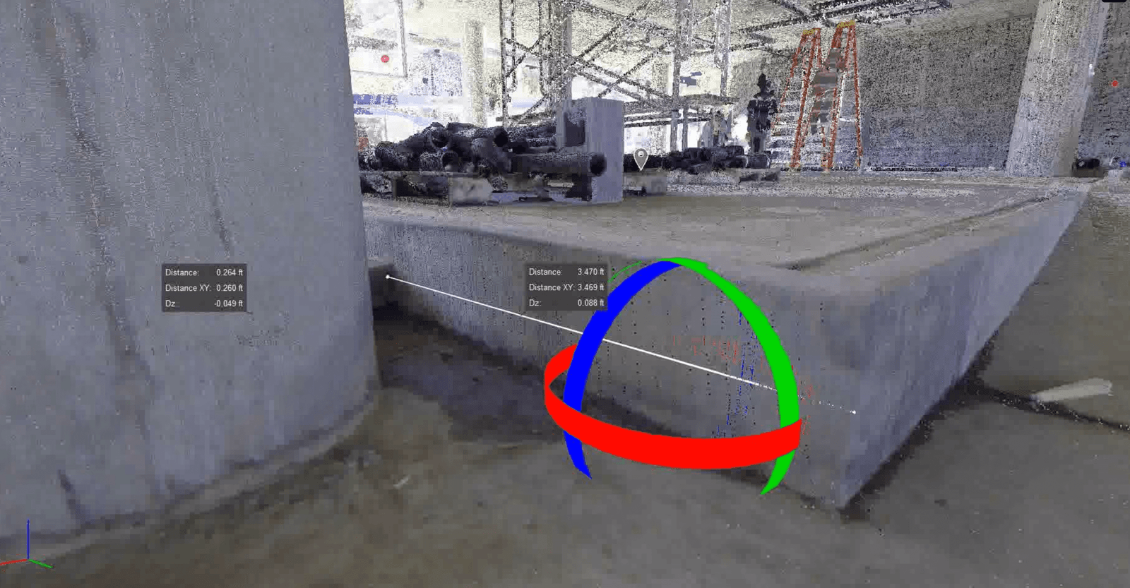
3D Lidar Scanning for accurate measurements
-
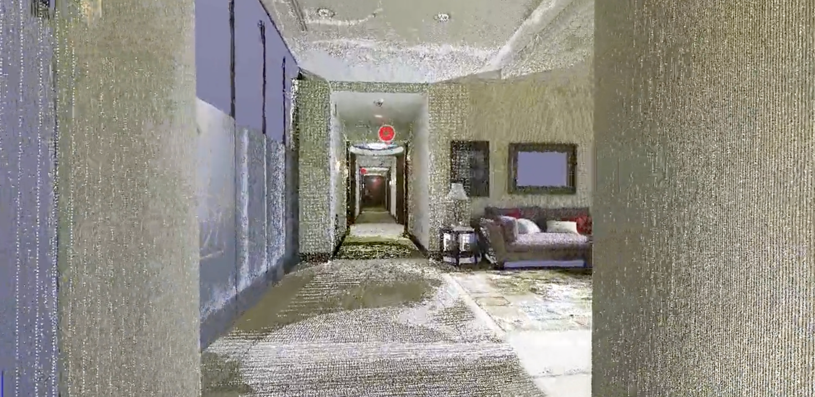
Residential Hallway Fly Through
See how pinpoint accurate measurement can be taken once the point cloud laser mapping is created with LiDAR 3D scanning.
-
Precision 3D Scanning construction services Field Measure Point Cloud

Here we have a video flythrough that immerses you in a detailed digital world. This video isn’t just a visual tour; it’s a transformative experience that converts into a precise point cloud. As you navigate through the space, advanced LiDAR technology captures every detail with laser pulses. Once the flythrough ends, the captured data processes…
-
Lidar Scan prior to TI Buildout

Lidar Scan of concrete to develop an elevation heat map
Revolutionizing the Construction Industry with Point Cloud 3D Scans