Point Cloud Scanning in Denver for Accurate BIM & Floor Plans
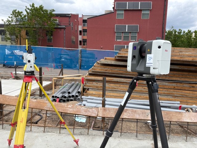
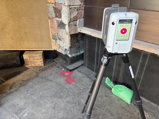
At Precision 3D Scanning, we provide point cloud scanning in Denver that delivers millimeter-accurate data for architects, engineers, contractors, and property managers. Using our Leica RTC360 LiDAR scanner, we capture millions of data points from your building or site and transform them into a highly detailed point cloud — a digital replica of real-world conditions. This process ensures you have the most reliable starting point for design, construction, or renovation.
Whether you need to create as-built drawings, BIM models, or floor plans, point cloud scanning eliminates the guesswork that comes with manual measurements or outdated documents. Our scans can be used to verify square footage for real estate transactions, evaluate concrete levelness and flatness (FF/FL), or generate detailed digital fly-throughs for presentations. From concrete elevation heat maps to full Scan-to-BIM workflows, we provide a complete solution that saves time, reduces risk, and gives your team the confidence of building with precision.
What is a Point Cloud?
A point cloud is a collection of millions of 3D measurement points captured by a laser scanner. Each point represents an exact position in space, which together creates a highly detailed digital replica of your building, site, or structure. This digital dataset forms the foundation for floor plans, elevations, 3D models, and virtual walkthroughs.
By working from point clouds, architects, engineers, contractors, and property owners can eliminate guesswork, reduce errors, and keep projects on schedule.
Benefits of Point Cloud Scanning in Denver
Point cloud scanning is more than just measuring — it’s about providing clarity and confidence at every stage of your project:
- Square Footage Verification – Realtors, property managers, and buyers can confirm accurate building area calculations before a sale.
- Floor Plan Creation – Generate clean, professional floor plans directly from scans, perfect for design, permitting, or marketing.
- Digital Fly-Throughs – Immerse yourself in a 3D walkthrough of a property, ideal for client presentations and remote collaboration.
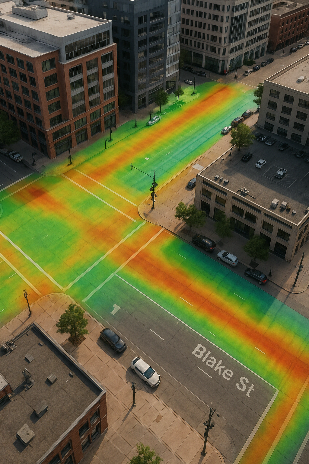
- Concrete Elevation Heat Maps – Identify high and low spots with color-coded precision to support flooring installs, coatings, or slab corrections.
- Levelness & Flatness Testing (FF/FL) – Verify slab tolerances against ASTM standards, ensuring surfaces meet specifications.
- Scan-to-BIM Models – Convert raw point cloud data into detailed Revit models for use in design, coordination, and construction planning.
Why Point Clouds Are Better Than Traditional Measurement
Traditional methods rely on tape measures or 2D photos that miss critical details. A point cloud delivers a true-to-condition snapshot that captures every angle, slope, and surface. For projects with tight schedules, irregular geometry, or complex structures, laser scanning drastically reduces rework and saves both time and money.
In fast-moving industries like construction and real estate, having complete as-built data up front helps avoid costly mistakes later.
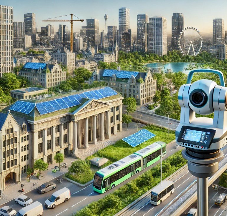
Serving Denver and Beyond
Based in Arvada, Colorado, we proudly serve clients across the Denver metro area and the Front Range. From residential remodels to large-scale commercial projects, our scans support architects, engineers, contractors, property developers, and realtors who demand accuracy.
Whether you’re preparing for a renovation, documenting existing conditions, or verifying new construction, our point cloud services provide the reliable data foundation you need.
Request a Quote
Ready to see how point cloud technology can improve your project? Contact Precision 3D Scanning today for a fast, no-obligation quote. We’ll help you turn real-world conditions into usable, accurate digital data that drives better results.
Point Cloud History
With nothing like it before, the evolution of point cloud technology has transformed the construction industry. We provide Point Cloud Mapping solutions tailored for the AEC industry. Previously, architects used AutoCAD to create 2D plans, drawing elevations for east/west walls, and so on. Now, point clouds enable 3D renditions and allow architects to model those elevations in full 3D.
For renovation projects, if an architect was hired to renovate a building, they had to go on-site to take physical measurements, and if any details were missed, another visit would be required to gather additional information. There were always gaps. 3D LiDAR technology eliminates those gaps by capturing measurements digitally at a rate of two millimeters per second.
Given that LiDAR technology has only been in use for about a decade, there’s no doubt that it can make your next project the best it can be.
The Revolution of Point Cloud
The advent of point cloud technology has revolutionized construction, prioritizing safety, compliance, and enhanced efficiency. Previously, architects relied on AutoCAD to create 2D plans, drawing individual elevations for each wall, such as east or west views. Now, point cloud technology enables the creation of 3D models of these elevations, providing a comprehensive view with greater accuracy and precision.
For renovation projects, architects traditionally had to take manual measurements on-site, often requiring multiple visits if details were missed—leading to gaps in data and potential errors. With 3D LiDAR scanning, measurements are captured digitally at a rate of every 2 millimeters per second, ensuring no detail is overlooked. This eliminates the need for repeated site visits, saving time and costs while supporting rigorous safety and compliance standards. Though LiDAR has only been widely used for around a decade, it’s clear that it will set new benchmarks for project success in construction and design.
Resources for the AEC Industry
See latest samples on how Point Cloud Technology is changing the way we build.
-
LiDAR vs Total Station: Understanding the Tools That Build and Verify the Modern Jobsite
LiDAR and total stations aren’t rivals—they’re complementary. Learn how both tools define accuracy and efficiency on Colorado jobsites with Precision 3D Scanning.
-
LiDAR Scanning in Urban Development: Protecting Developers From Hidden Risks
A detailed curb and gutter section with storm drain, overlaid with a vibrant LiDAR elevation heatmap. The color gradient highlights changes in elevation along the road and sidewalk, demonstrating how LiDAR scanning helps developers analyze drainage flow and protect urban projects from future infrastructure risks.
-
Precision 3D Scanning: When to Tie LiDAR Scans to Survey Control in Denver and Colorado Projects
On-site with the Leica RTC360 in Denver, Precision 3D Scanning ties LiDAR scans to survey control points for unmatched accuracy. This workflow ensures dependable as-builts, eliminates costly errors, and provides architects, engineers, and contractors with the verified data they need for successful construction projects
Common questions related to point cloud technology
Scanning Scope and Complexity
The size and complexity of the scanning area can significantly impact pricing. Larger or more intricate environments may require more time and resources to scan, process, and analyze the data, leading to higher costs.
Resolution and Detail Requirements
The level of detail and resolution needed for the project can also affect pricing. Higher resolution scans with greater detail will typically require more time and specialized equipment, resulting in higher costs.
Accessibility and Site Conditions
The accessibility of the scanning site and the presence of obstacles or challenging conditions can impact pricing. Difficult-to-reach areas may require additional setup time or equipment, leading to increased costs.
Experience and Expertise
The experience and expertise of the scanning provider can also affect pricing. Providers with a proven track record, specialized knowledge, and advanced technology may command higher rates due to the added value they bring to the project.
Timeline and Urgency
Project timelines and turnaround times can influence pricing. Rush orders or projects with tight deadlines may require expedited processing and dedicated resources, resulting in higher costs to accommodate the accelerated schedule.
Additional Services
Additional services such as point cloud processing, data analysis, and visualization may incur extra charges. These services are often tailored to the specific needs of the project and can add value by providing actionable insights and deliverables.
Point Cloud Demonstration
A point cloud video fly-through provides a powerful, immersive way to demonstrate the capabilities of 3D scanning technology. This type of visualization showcases the precision and depth of point cloud data, allowing viewers to navigate through intricate details of a scanned environment. By moving through the 3D space, stakeholders can gain a true sense of scale and spatial relationships, which is invaluable for applications in architecture, construction, and even virtual reality. This bird’s-eye view not only enhances understanding but also enables better planning, as it highlights areas for improvement and aids in the identification of potential challenges before they arise on-site.
Empower your next job with Precision 3D Scanning.
Get started by telling us about your next project.