Scan to BIM Vail: Creating a Reliable Foundation for a Concert Hall Renovation
Every Renovation Begins with Existing Conditions
Every renovation project begins with a building that already has a history.
Long before an architect sketches the first design concept, that building has been repaired, renovated, expanded, and adapted over many years. Mechanical systems have been replaced, walls have moved, roof structures have changed, and countless decisions have shaped the building into what it is today. Some of those changes were documented. Many were not.
That’s why existing condition documentation has become one of the most important steps in renovation planning.
A recent Scan to BIM project in Vail, Colorado demonstrates exactly why.
A general contractor contacted Precision 3D Scanning before the architect began designing renovations to a local concert hall. Rather than relying on decades-old drawings or asking the design team to rebuild the building through field measurements, they wanted to begin with accurate information that reflected the building as it existed today.
That decision established the foundation for every design decision that followed.
Starting the Design Process with Measured Reality
Architects solve problems every day.
They coordinate new systems within existing buildings, develop creative solutions for aging structures, and balance owner expectations with construction realities. None of that work becomes easier when the existing documentation cannot be trusted.
Every missing dimension introduces uncertainty.
Every undocumented modification creates another question that eventually needs an answer.
The contractor understood that before design ever began.
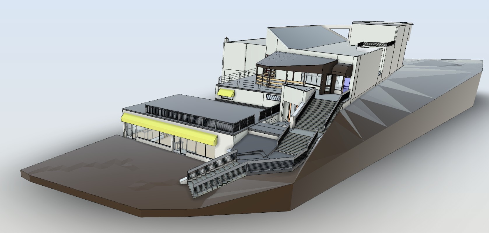
Instead of asking the architect to interpret incomplete drawings, they invested in a complete Scan to BIM workflow. Our team captured the concert hall and surrounding buildings with high-accuracy LiDAR scanning before developing a Revit model directly from the measured point cloud.
The objective wasn’t simply to produce another digital model.
The objective was to eliminate uncertainty before it became part of the design process.
A Building That Has Evolved Over Time
Buildings rarely remain exactly as they were originally designed.
Public facilities, especially performance venues, evolve continuously. Mechanical equipment changes. Accessibility improvements are added. Interior spaces are renovated. Building systems are upgraded to meet modern codes and changing operational needs.
Every renovation adds another layer to the building’s history.
Original drawings become less representative of reality with every improvement that takes place.
That creates challenges for architects who need accurate information before committing to new design decisions.
It also creates challenges for contractors who must estimate, coordinate, and ultimately build the project.
The contractor on this project wanted to remove as much uncertainty as possible before the architect began working. They recognized that measured existing conditions would provide a stronger starting point than relying on assumptions or incomplete documentation.
Capturing the Concert Hall with LiDAR Scanning
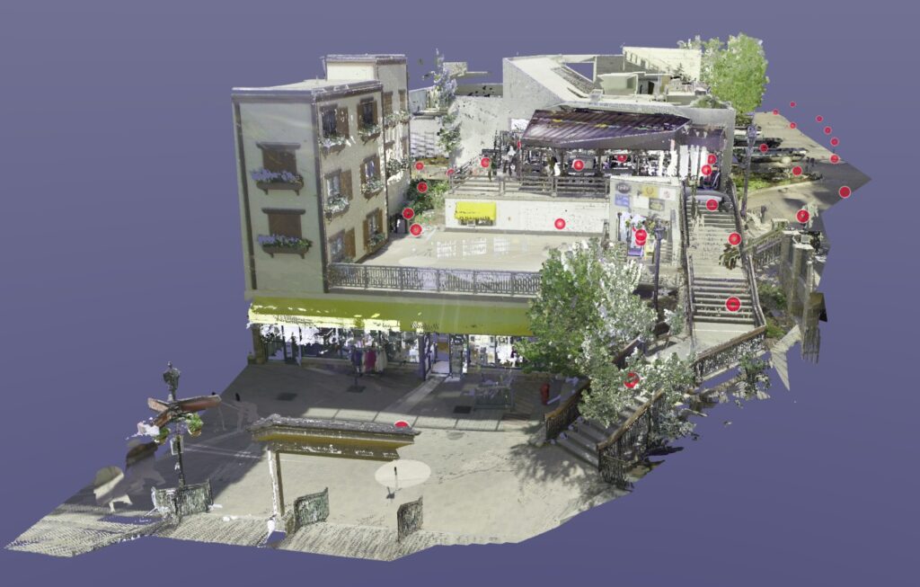
Our team completed a comprehensive LiDAR scan of the concert hall and surrounding buildings in Vail. Every scan position captured millions of individual measurements that documented the geometry of the building with a high degree of accuracy.
Unlike traditional field measurements, LiDAR scanning records the entire environment rather than isolated dimensions. Exterior walls, rooflines, architectural features, entrances, structural elements, and surrounding site conditions all become part of a single coordinated dataset.
That level of documentation gives the design team something far more valuable than individual measurements.
It gives them context.
Months after the site visit, the architect can return to the point cloud to verify dimensions, answer design questions, or better understand how one portion of the building relates to another. Instead of scheduling another trip to Vail, the information already exists within the digital record created during the scan.
Building a Revit Model the Design Team Could Use
Capturing the point cloud was only the beginning.
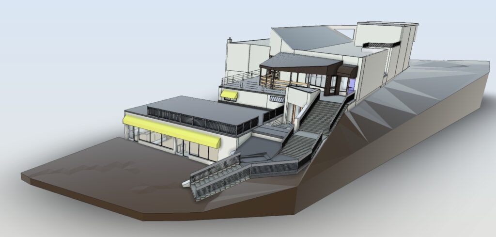
Once the field work was complete, we processed the scan data and developed a Revit model that accurately represented the building’s existing conditions.
https://www.autodesk.com/products/revit/overview
That distinction matters.
The architect wasn’t handed a conceptual model or an approximation of the building. They received a model built directly from measured field data, allowing them to begin designing immediately instead of spending valuable time recreating the existing facility.
Every hour an architect spends rebuilding an existing building is an hour they cannot spend solving design challenges.
By starting with verified existing conditions, the design team could focus on what they were hired to do: create a successful renovation that respected the existing building while preparing it for its next chapter.
The technology made that possible, but technology wasn’t the reason the contractor picked up the phone.
They wanted confidence that the architect was designing from measured reality.
Confidence that everyone involved in the project would begin with the same accurate information.
Confidence that important decisions would be based on facts instead of assumptions.
That is where Scan to BIM delivers its greatest value.
Better Information Creates Better Design
The Revit model became much more than another project deliverable. It became the foundation the entire design team could build from.
Every renovation project depends on decisions made during design. Architects evaluate existing spaces, engineers determine how new systems will fit within the building, and contractors begin developing budgets, schedules, and construction strategies. Every one of those decisions depends on having accurate existing conditions.
Starting with a verified Scan to BIM model gave the project team something they could trust from the very beginning. Instead of recreating the building from incomplete information, the architect could begin designing immediately using a Revit model developed from measured field data. That shift allowed the team to spend more time solving design challenges and less time verifying dimensions or questioning whether existing drawings still reflected reality.
That confidence extended well beyond the architect’s office.
Structural engineers could evaluate existing framing with greater certainty before designing new connections. Mechanical engineers gained a reliable understanding of available space for ductwork, piping, and equipment. Electrical engineers could coordinate new systems knowing they were working from the same existing conditions as every other consultant. The contractor also benefited because everyone referenced the same model instead of relying on different sets of drawings or independent field measurements.
One accurate source of information creates consistency across an entire project.
Reducing Risk Before Construction Begins
Construction projects rarely lose time because of one major mistake.
More often, schedules begin slipping after a series of smaller issues appear throughout the project. An existing wall sits several inches away from its expected location. Roof framing differs from the original drawings. Mechanical systems occupy space that was assumed to be available. Every adjustment seems manageable by itself, but together they create redesign, coordination meetings, field modifications, and unnecessary delays.
Those situations become much easier to manage when they are discovered before design is complete.
That is one of the greatest advantages of a Scan to BIM workflow.
Instead of allowing uncertainty to move downstream into construction, the project team addresses it while design is still flexible. Adjustments made during planning generally cost far less than corrections made after fabrication, procurement, or installation has already begun.
The contractor recognized that value from the beginning.
By investing in accurate existing conditions before the architect started designing, they reduced the likelihood of discovering expensive surprises later in the project.
A Digital Record That Continues Creating Value
The value of a LiDAR scan does not end when the Revit model is delivered.
The point cloud becomes a permanent digital record of the building as it existed on the day it was scanned. As the project moves forward, that information continues supporting the design team whenever new questions arise.
Perhaps an architect needs to verify the dimensions of an area that was not part of the original design discussion. A structural engineer may need to review an existing connection before finalizing details. The contractor might want to confirm a measurement before ordering materials or coordinating work with another trade.
Without reality capture, each of those questions could require another trip to the site.
With a complete point cloud and a verified Revit model, the answers are often already available.
The project team simply returns to the digital building.
That capability saves time throughout design and construction while giving everyone greater confidence in the decisions they make.
Why More Contractors Are Choosing Scan to BIM
Contractors understand that uncertainty becomes more expensive as a project progresses.
The earlier questions are answered, the easier they are to solve.
That understanding is one of the reasons Scan to BIM has become an important part of renovation planning throughout Colorado. Rather than asking architects to work from outdated documentation, more contractors are choosing to begin with measured existing conditions that accurately represent the building before design starts.
The technology behind LiDAR scanning continues to improve every year, but the reason contractors invest in it has remained remarkably consistent.
They want better information before committing to important decisions.
Accurate existing conditions improve communication between project teams, simplify coordination across multiple disciplines, and reduce the risk of discovering costly conflicts after construction begins.
The result is not simply a better model.
The result is a better project.
Lessons from the Vail Concert Hall Project
Every renovation project is unique, but the questions at the beginning are almost always the same.
Does the existing building match the drawings? Has anything changed since the last renovation? Can the design team rely on the information they have, or are they making decisions based on assumptions?
Those questions don’t just affect architects. They influence every consultant, contractor, and owner involved in the project. The quality of the decisions made during design depends on the quality of the information available at the time.
That’s why this Scan to BIM project in Vail was about much more than creating a Revit model.
The contractor wanted the architect to begin the project with confidence. By documenting the building before design started, the team established a common understanding of the existing conditions. Everyone worked from the same measured information, which reduced uncertainty before it had the opportunity to affect design, coordination, or construction.
That investment continues creating value long after the scanning is complete. The point cloud becomes a permanent record of the building at a specific moment in time, while the Revit model gives architects, engineers, and contractors a reliable foundation for future work. As additional renovations, tenant improvements, or maintenance projects arise, that information remains available instead of requiring the building to be documented again from scratch.
The technology behind LiDAR scanning is impressive, but technology alone doesn’t improve a project.
Better decisions improve projects.
Accurate information allows those decisions to happen earlier, when changes are easier to make and far less expensive. That simple idea explains why more contractors are choosing to document existing conditions before design begins instead of waiting until questions appear during construction.
Why Existing Conditions Should Be Part of Every Renovation
Renovation projects rarely fail because someone drew the wrong line.
More often, problems begin when the project team discovers that the building doesn’t match the information they used during design.
A missing beam. An unexpected roof elevation. Mechanical equipment that isn’t where the drawings show it. Structural framing that changed during a previous renovation.
None of those discoveries are unusual.
What matters is when they’re discovered.
Finding them during planning gives the team options.
Finding them after demolition, fabrication, or installation usually costs time and money.
That’s why documenting existing conditions has become an essential part of successful renovation projects. Whether the building is a concert hall, a healthcare facility, a school, a data center, or a commercial office, the process begins the same way.
Understand what exists before deciding what comes next.
Partner with Precision 3D Scanning
At Precision 3D Scanning, we help architects, engineers, contractors, and owners begin renovation projects with confidence. Our LiDAR scanning, Scan to BIM, Revit modeling, and existing conditions documentation services provide accurate field data that supports better planning, stronger coordination, and more informed decisions throughout design and construction.
From historic buildings in downtown Denver to mountain projects in Vail and large commercial facilities across Colorado, our goal remains the same. We replace assumptions with measured reality so project teams can focus on solving problems instead of searching for information.
If you’re planning a renovation, adaptive reuse project, tenant improvement, or facility upgrade, we’d be happy to discuss how accurate existing conditions can support your project before design begins.
Because every successful renovation starts with understanding what is already there.
Construction works better when truth is clear, shared, and measurable.
Frequently Asked Questions
What is Scan to BIM?
Scan to BIM is the process of capturing a building with LiDAR scanning and converting the measured point cloud into a Revit model or other Building Information Model. Architects, engineers, and contractors use the model as a reliable foundation for renovation design and project coordination.
Why should existing conditions be documented before renovation?
Accurate existing conditions reduce uncertainty during design. They help architects and contractors identify potential conflicts early, improve coordination between disciplines, and reduce the risk of costly field changes after construction begins.
What level of accuracy does LiDAR scanning provide?
The accuracy depends on the equipment, project requirements, and survey control. Precision 3D Scanning uses Leica RTC360 technology and follows workflows designed to provide highly accurate existing-condition documentation suitable for architectural, engineering, and construction projects.
Does every renovation project need a full building scan?
No. Many projects only require the portions of the building that will be affected by the renovation. The scope of the scan should match the scope of the design, allowing the project team to collect the information they need without documenting areas that won’t influence the work.
Can a Revit model reduce future site visits?
Yes. A Revit model developed from a LiDAR scan allows architects, engineers, and contractors to verify dimensions and review existing conditions from the office. While some field verification may still be necessary, many questions can be answered using the model and point cloud, reducing unnecessary trips to the site.