
The Basement Told a Different Story
Everything looked fine at 1855 Blake in downtown Denver… until we scanned the existing conditions.
This project shows exactly how existing conditions laser scanning in Denver reveals what drawings miss and why that matters before design moves too far forward.
We went to the site to document conditions for a renovation. The owner planned to convert two street-level spaces into retail and use additional space below in what could loosely be called a basement.
At first, nothing about that scope raised concern. Projects like this happen all the time in older parts of the city. Teams usually move forward using whatever drawings exist and fill in the gaps as they go.
At the street level, the building behaved as expected. The layout aligned reasonably well with the available documentation, and nothing stood out as unusual.
Then we went downstairs.
The lower level told a completely different story.
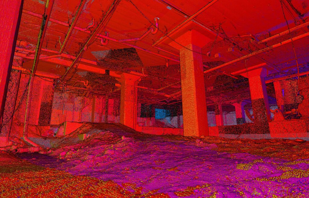
The space included 3-foot-thick brick walls that crews had heavily modified over time. Over the years, workers cut openings into the structure, expanded penetrations, and routed infrastructure wherever it needed to go to support the building above. While each change solved an immediate problem, no one coordinated those modifications into a clear record.
As a result, the building now reflects decades of layered decisions.
The drawings did not show any of it clearly.
When Drawings Stop Reflecting Reality in Existing Conditions Scanning
Projects begin to shift when documentation no longer matches what exists, especially on projects that skip proper existing conditions scanning.
At that point, the gap between expectation and reality creates risk. If teams ignore it, that risk usually surfaces during construction, when time is limited and decisions carry more weight.
In this case, the schedule at 1855 Blake did not allow that kind of delay.
Design still needed to move forward. At the same time, coordination had to happen. The team could not stop and try to piece together conditions in the field.
Because of that, the architect made a critical decision.
Instead of continuing forward with incomplete information, they chose to capture the existing conditions directly.
That decision changed the direction of the project.
Capturing Existing Conditions with Laser Scanning
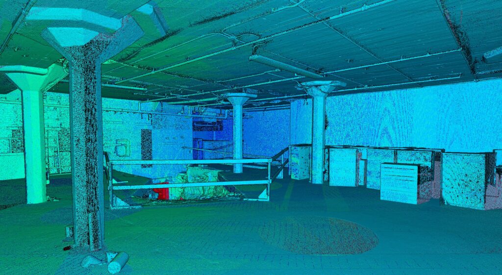
From there, we used existing conditions laser scanning to capture both the street-level spaces and the lower level exactly as the building stands today.
We did not rely on original design intent, and we did not rely on outdated drawings. Instead, we documented the space as it actually exists.
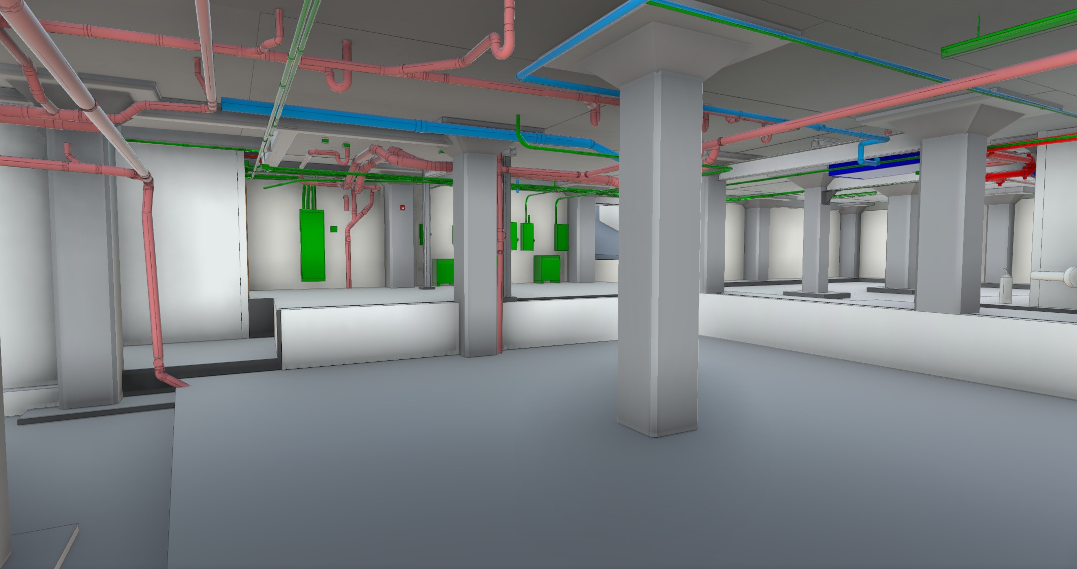
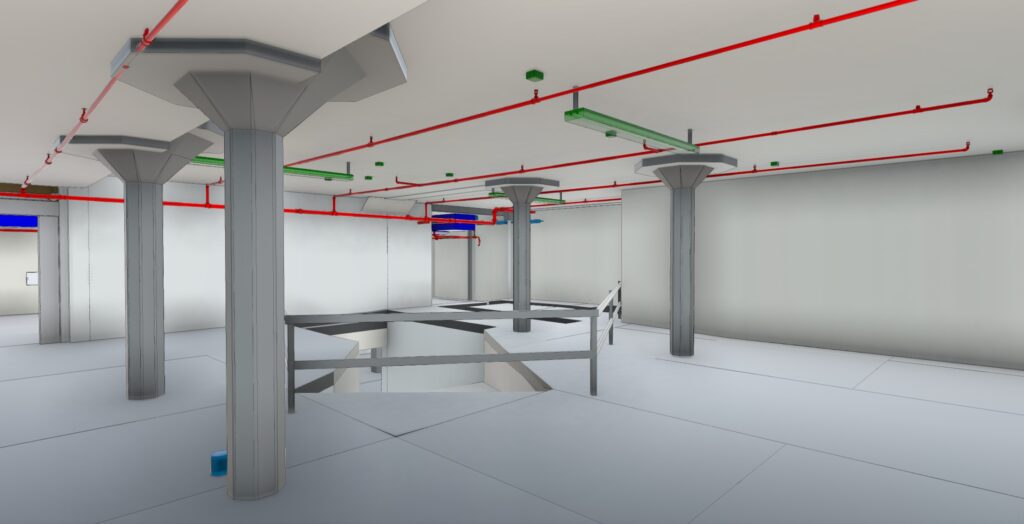
Using that data, we built a detailed Revit model at LOD 300. The model includes structural, architectural, and MEP systems based on the captured conditions.
The dataset maintains millimeter-level accuracy within the scan data, providing a reliable foundation for design and coordination.
This work was not about visualization.
The team needed something they could trust.
What the Team Could Finally See
Once the model was complete, the design team gained a clear understanding of the building.
They could see how the upper and lower levels relate. They could identify where walls actually land. They could also evaluate how previous modifications affect the space.
Because of that clarity, decision-making changed.
Instead of asking whether something will fit, the team focused on how it should be designed.
What Happens Without Existing Conditions Laser Scanning
Even when information is incomplete, projects do not stop.
Instead, they move forward with hidden risk.
Eventually, that risk shows up in the field.
At that point, crews stop work to verify conditions. Installers adjust layouts on the fly, while engineers review unexpected conflicts. Each of these actions takes time.
Unfortunately, that time does not exist in the schedule.
How Schedules Start Slipping
Field adjustments rarely appear in the original plan.
Instead, they begin with small issues.
A wall does not land where expected.
A penetration interferes with a new system.
Clearances do not meet design intent.
Because of these conditions, each issue requires a decision.
And every decision takes time.
Over time, those delays affect sequencing. They disrupt coordination and create friction between trades.
Schedules do not fail because of one major issue.
More often, they slip because smaller problems stack up.
Why This Decision Mattered
At 1855 Blake, the team chose to understand the building early.
As a result, they replaced assumptions with measurable information.
Design moved forward with confidence instead of hesitation. At the same time, coordination happened before construction instead of during it.
That decision protected the schedule.
Why Existing Conditions Laser Scanning Matters in Denver
Across Denver, many older buildings continue to be adapted for new uses. However, most of these structures have gone through multiple renovations without a complete record of changes.
Because of that, a consistent challenge emerges.
Drawings rarely reflect current conditions.
Structural elements change. MEP systems get rerouted. Spaces evolve over time.
At the same time, projects in downtown Denver operate under tight schedules and limited space.
As a result, teams do not have room for trial and error.
Existing conditions laser scanning in Denver addresses that challenge by capturing the building as it exists. With that information, teams gain accurate, measurable data before design moves too far forward.
That leads to better decisions, stronger coordination, and fewer surprises during construction.
Final Thoughts
Everything looked fine at first.
The basement proved otherwise.
The team chose to understand the building early. That decision allowed the project to move forward with fewer unknowns and a stronger foundation for what comes next.
Precision 3D Scanning brings clarity to construction by measuring reality, not assumptions.
Clarity to Construction
If you are working on an existing building where conditions are unclear, it makes sense to understand what is actually there before design moves too far forward.
Reach out if you want to talk through whether existing conditions laser scanning in Denver would help on your project.