
When City Approvals Stop a Project
Construction projects rarely stall because someone forgot how to build.
They stall because the information needed to move forward does not exist, is incomplete, or cannot be verified.
That was the situation facing a newly mobilized property in Morrison, Colorado.
The owner was in the process of repurposing a multi-building site. Crews were engaged, planning was underway, and the project was moving forward, until the city came back with comments requiring significantly more documentation than had been submitted or anticipated.
Floor plans were missing.
Exterior elevations were incomplete.
Roof geometry had not been documented.
Site grading and paving slopes could not be reviewed for drainage compliance.
Without those items, approvals could not proceed. The project was effectively stopped.
This is where verified existing conditions become more than a “nice to have.” They become the difference between progress and delay.
The Reality of Repurposing Existing Properties
Adaptive reuse and property repurposing projects often begin with optimism. Existing buildings are assumed to be understood, previous documentation is expected to exist somewhere, and the focus naturally shifts toward future design rather than present conditions.
In reality, many properties, especially those that have changed hands multiple times, lack reliable documentation. Drawings may be outdated, incomplete, or inconsistent with what actually exists in the field. Renovations may have occurred without full records. Site grading may have changed incrementally over time.
Cities do not review assumptions.
They review documentation.
When a city requests verified floor plans, elevations, roof geometry, and site drainage information, teams are required to demonstrate existing conditions as they truly are—not as they are remembered or inferred.
In this Morrison project, the absence of that documentation became apparent only after mobilization had already begun.
Project Overview: Existing Conditions at Scale
The scope of the Morrison site added complexity to the situation.
The property consisted of:
- Four existing buildings
- Approximately 12,000 square feet total
- A 150,000 square foot site, including paving, access areas, and drainage paths
The city required a full set of existing-condition drawings to continue review:
- Architectural floor plans
- Exterior elevations
- Roof geometry
- Site plans showing paving slopes and drainage
None of these could be verified using existing records.
At that point, the challenge was not design or construction. It was documentation, quickly, accurately, and defensibly.
Why Assumptions Fail in City Review
When timelines are tight, teams often try to reconstruct existing conditions using partial information. Old drawings are redlined. Measurements are spot-checked. Site grades are approximated based on visual inspection or limited survey points.
This approach carries risk.
Cities increasingly require:
- Clear verification of dimensions
- Consistency across plans and elevations
- Demonstrated drainage intent based on measured slopes
- Documentation that aligns across architectural and site drawings
Any inconsistency triggers additional comments, resubmittals, and delays.
In this case, attempting to “fill in the gaps” would have cost more time than capturing reality directly.
Mobilizing Quickly Without Compromising Accuracy
Time mattered.
The project was already mobilized when the city comments arrived. Waiting weeks to assemble documentation would have extended delays and increased downstream impacts.
Precision 3D Scanning documented the site as it actually exists, creating a verifiable record of existing conditions with LiDAR.
Within 48 hours, the team was onsite.
All four buildings were scanned, including:
- Interior spaces
- Exterior façades
- Roof geometry
- Surrounding site features
The site paving, grades, and drainage paths were measured in full context, allowing slope and elevation relationships to be clearly documented.
The goal was not to create a model for visualization.
The goal was to produce accurate, review-ready documentation the city could rely on.
From Point Cloud to City-Ready Drawings
LiDAR scanning provides a dense, measurable record of existing conditions. However, raw scan data alone does not satisfy city requirements. The value lies in converting that data into usable, interpretable deliverables.
From the captured data, the following were produced:
Existing-Condition Floor Plans
Accurate floor plans were generated directly from measured geometry. Wall locations, openings, and spatial relationships reflected actual conditions rather than legacy drawings.
Exterior Elevations
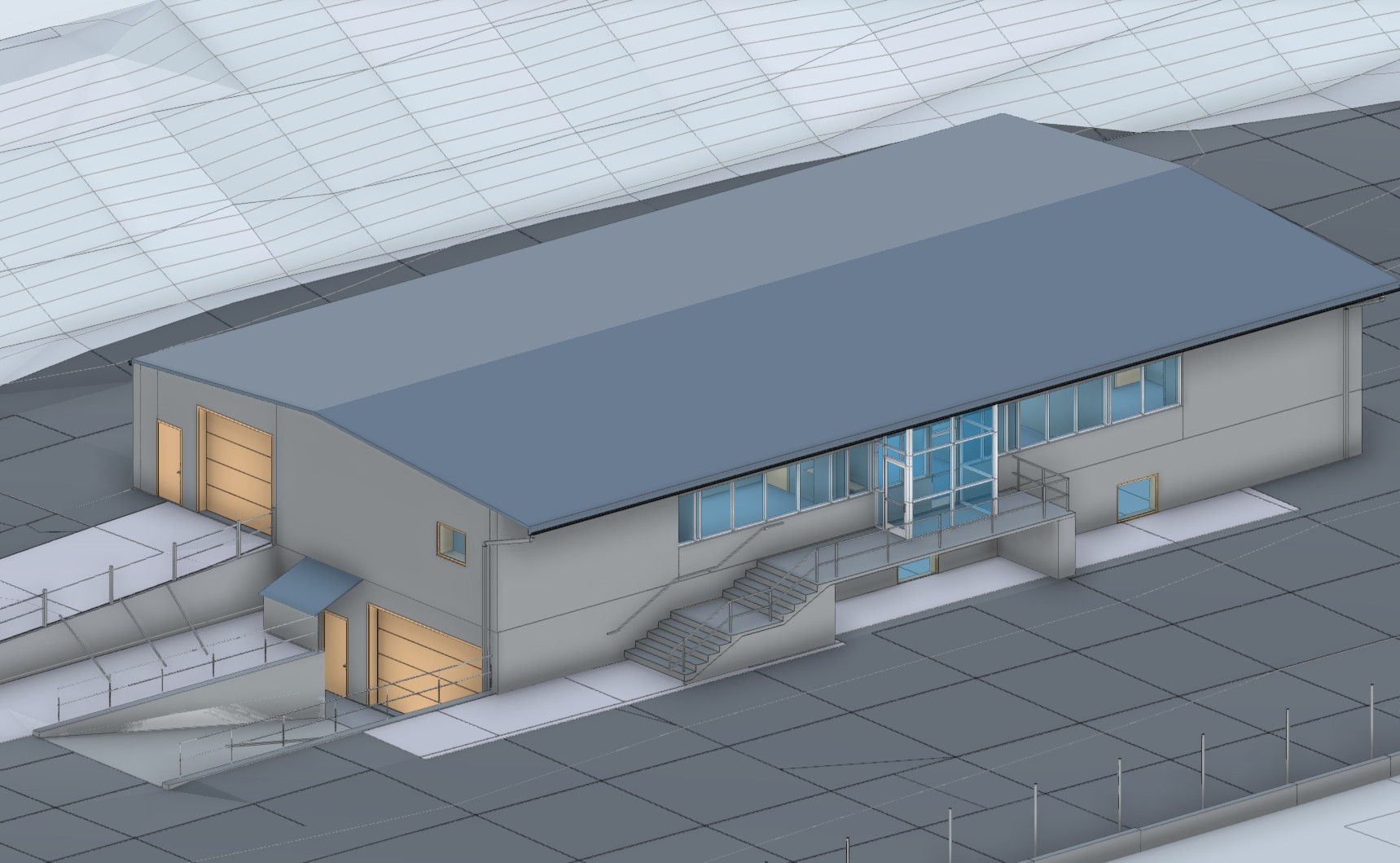
Exterior elevations were created to show building height, façade conditions, and alignment. These elevations allowed the city to review massing and exterior compliance based on verified data.
Roof Geometry
Roof slopes, edges, and configurations were documented to support review and coordination. This eliminated uncertainty around roof conditions that often causes review delays.
Site Plans with Slopes and Drainage
The 150,000 square foot site was documented to show paving extents, elevation changes, and drainage paths. Slopes were measured, not assumed, allowing the city to assess drainage behavior accurately.
All required deliverables were completed and delivered within seven days.
Why Speed Matters When Accuracy Is Required
Many teams assume fast turnaround sacrifices quality. With the right tools and workflows, speed and accuracy reinforce each other.
LiDAR allows teams to:
- Capture comprehensive data in a single mobilization
- Reduce return trips
- Avoid rework caused by missing measurements
- Answer follow-up questions without re-measuring
In this project, rapid turnaround did not come from cutting corners. It came from eliminating guesswork.
Once we scanned the site, the data became a single source of truth. That clarity allowed the team to produce drawings efficiently and confidently, without returning to the field or second-guessing conditions.
The Impact on the Project Timeline
With verified existing-condition drawings in hand, the project team was able to resubmit to the city and move forward with review.
The stoppage caused by missing documentation was resolved not by revising assumptions, but by replacing them with measured reality.
This outcome is increasingly common as cities tighten review standards and expect higher-quality documentation earlier in the process.
Why This Approach Works for Owners, Architects, and Cities
Each stakeholder benefits differently from verified existing conditions:
Owners
- Reduced downtime after mobilization
- Fewer surprises during review
- Clear understanding of what exists before investing further
Architects and Designers
- Reliable base information for design decisions
- Fewer revisions due to incorrect assumptions
- Cleaner coordination across disciplines
Cities and Reviewers
- Documentation they can trust
- Clear, consistent drawings
- Reduced back-and-forth during review
When existing conditions are measured and documented early, all parties operate from the same reality.
Lessons from the Morrison Project
Several takeaways stand out from this project:
- Existing conditions are often underestimated
Even well-intentioned teams may not realize how incomplete their documentation is until review begins. - City requirements are becoming more specific
Generalized drawings and inferred grades are less acceptable than they once were. - Speed matters most after mobilization
Delays are more costly once crews, consultants, and schedules are already engaged. - Measured truth simplifies decision-making
When reality is documented clearly, approvals become procedural rather than contentious.
Why Verified Existing Conditions Should Happen Earlier
This project resolved successfully, but it also reinforces a key lesson: capturing existing conditions before mobilization delivers the greatest value.
Early verification:
- Reduces approval risk
- Improves cost certainty
- Prevents schedule disruption
- Strengthens coordination
However, when projects are already underway, fast, accurate documentation can still recover momentum, as it did here.
Bringing Clarity to Construction
This Morrison project is a clear example of why Precision 3D Scanning exists.
Construction works better when truth is clear, shared, and measurable. Replacing ambiguity with verified reality helps projects move forward with fewer conflicts and delays.
When teams need documentation early or under pressure, measured existing conditions give them the clarity to make confident decisions.