Enhancing Accuracy and Efficiency in Inspections
Third-party inspections in construction play a crucial role in ensuring quality, safety, and compliance with project specifications. LiDAR Scanning for Third-Party Construction Inspections is enhancing this. Traditional methods rely on manual measurements and visual assessments, which can be time-consuming and prone to human error. 3D LiDAR scanning transforms this process by providing high-precision, real-time digital documentation of as-built conditions. This allows for more accurate assessments and proactive decision-making, reducing costly rework and project delays.
Identifying the Need for Inspection in a Specific Area
Not all areas of a construction site require the same level of scrutiny. Certain elements are critical to long-term performance. 3D LiDAR scanning is particularly useful when verifying areas where accuracy is essential. Structural alignment, floor flatness, or MEP installations require pinpoint accuracy.
In one inspection, concerns arose about the levelness of a newly poured concrete floor, which was set to receive a glue-down flooring system requiring strict flatness tolerances. Traditional spot-checking methods would have required multiple measurements and still left room for missed inconsistencies. A full LiDAR scan provided a complete surface analysis, identifying variations that could impact the flooring’s performance before installation.
In another project, a steel frame structure was scanned to confirm that beam placements aligned precisely with the design. Any misalignment could have affected curtain wall installations, requiring costly modifications. With the LiDAR scan, these discrepancies were identified early, allowing for timely corrections before additional construction elements were put in place.
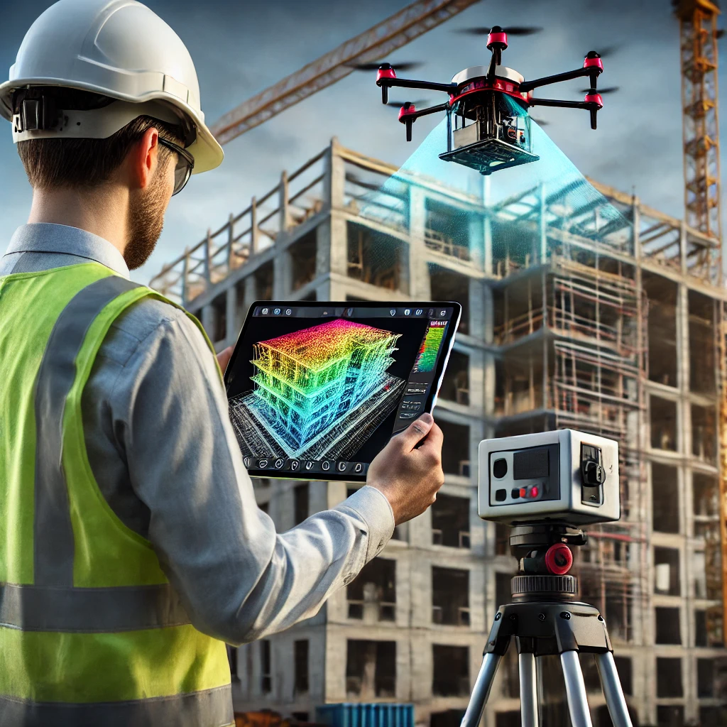
How 3D LiDAR Scanning Works in Inspections
LiDAR scanners, whether terrestrial or drone-mounted, capture millions of precise data points in minutes, generating an accurate 3D model of the site. During the inspection, the scanner records exact dimensions of the built environment, ensuring no measurement is overlooked. The raw point cloud data is then processed and aligned with the project’s BIM model or CAD drawings, making it possible to detect deviations, structural misalignments, and floor flatness variations.
Once processed, the scan is analyzed for compliance. Advanced software tools highlight any inconsistencies between the scanned as-built conditions and the original design. These analyses can reveal issues such as misaligned beams, out-of-position MEP systems, or sloped floors that may impact later construction phases.
Deliverable: What the Customer Receives
LiDAR Scanning for Third-Party Construction Inspections primary deliverable is a high-resolution 3D point cloud, which serves as an accurate digital representation of the construction site. This dataset is compatible with BIM and CAD software, allowing project teams to conduct their own analyses and make informed decisions based on precise as-built data.
Along with the point cloud, deviation heat maps provide a visual representation of areas where the construction differs from the original design. Cross-sections extracted from the scan highlight critical structural or installation discrepancies, helping teams focus on necessary adjustments.
For accessibility, an interactive cloud-based viewer allows stakeholders to explore the scanned data remotely, without the need for specialized software. Teams can examine the construction site in 3D, zoom into specific areas, and measure distances with high accuracy, facilitating efficient communication among project managers, engineers, and contractors.
How the Client Can Use the Point Cloud
The point cloud is a versatile asset that extends beyond the initial inspection process. When imported into Revit, it can be overlaid with existing BIM models. Thus enabling project teams to detect discrepancies between design and construction in real time. In Navisworks, the scan can be used for clash detection. While helping to resolve conflicts in structural, MEP, and architectural elements before construction progresses further.
For projects involving flooring installations, the point cloud can be analyzed in software such as Autodesk Recap or CloudCompare to assess flatness tolerances. If inconsistencies are detected, adjustments can be made before final flooring applications, preventing installation failures. Beyond construction, the scanned data serves as a long-term reference for future modifications, facility management planning, and dispute resolution, offering a permanent, digital record of the site’s as-built conditions.
The Future of Construction Inspections
3D LiDAR scanning is redefining third-party inspections by replacing traditional manual methods with precise, data-driven assessments. With this technology, construction teams can detect issues early, improve efficiency, and ensure compliance with industry standards. We capture a site in full detail. You compare it against the intended design brings a new level of accuracy and control to construction projects.
For professionals seeking greater confidence in their inspections, LiDAR scanning provides the insights necessary to mitigate risks. We streamline workflows, and enhance overall project outcomes. Investing in this technology ensures that every element of a build aligns with expectations. Assisting from earliest phases of construction to final project delivery.
For those interested in integrating 3D LiDAR scanning into their next project, a consultation can provide a tailored approach. Achieving the highest level of accuracy and efficiency in the inspection process.
How can Precision 3D Scanning assist on your next Project? Reach out to us here: https://precision3dscanning.com/lidar-scanner-pricing-request-a-quote-precision-3d-scanning/