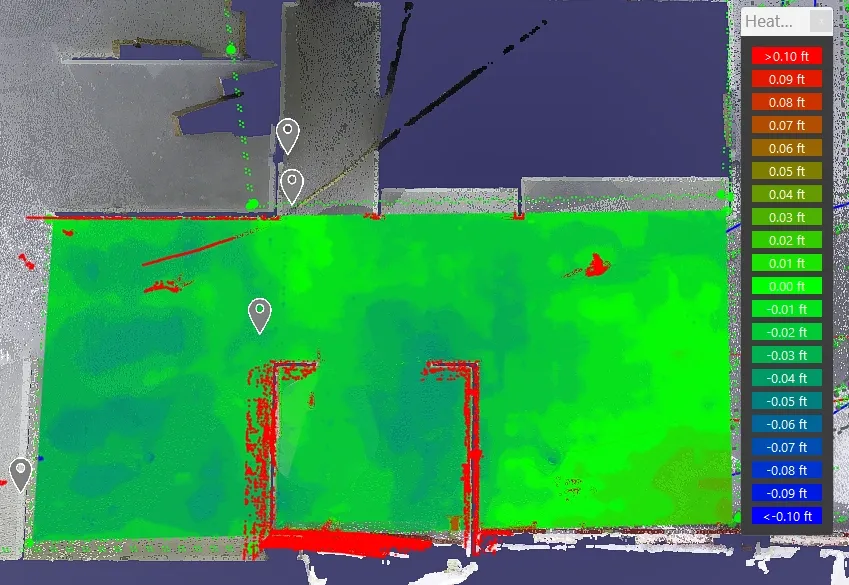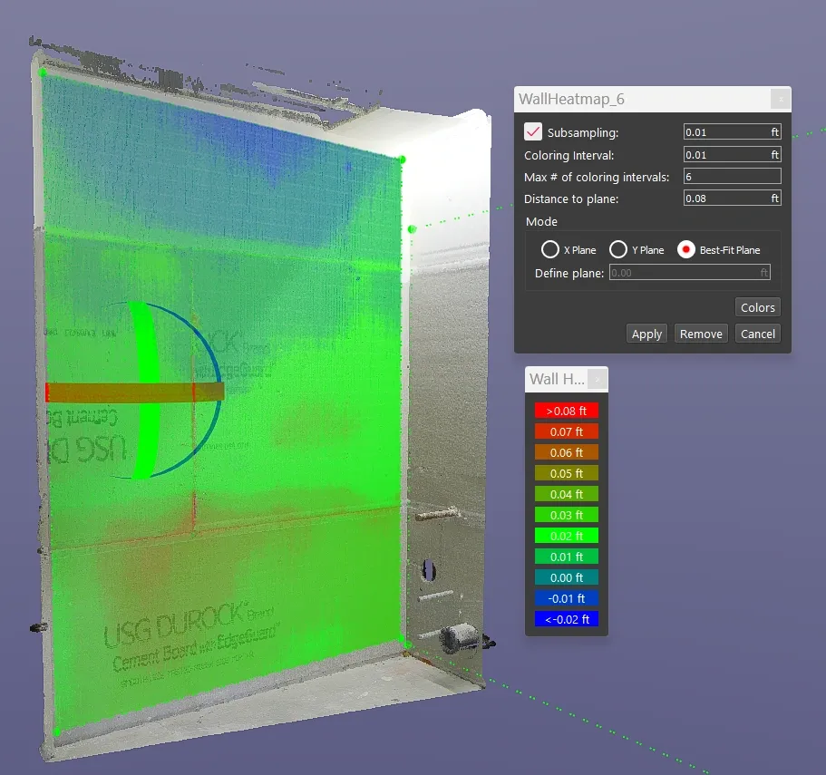
Use our construction service to go from plan to a 360 degree HDR Photo that you can measure. Point cloud creation with 3D scanning in the format of your choice to detailed reports such as a FF/FL Heat map of your project. Take virtual fly-through of your work in place.
Point cloud creation with 3D scanning
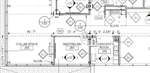
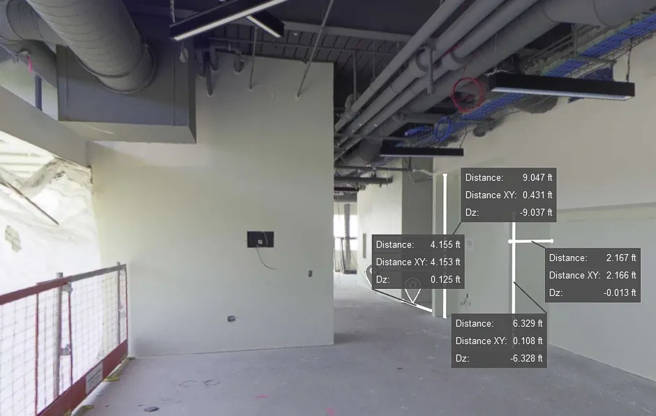
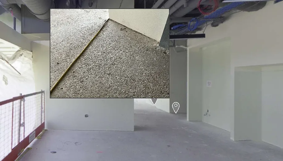
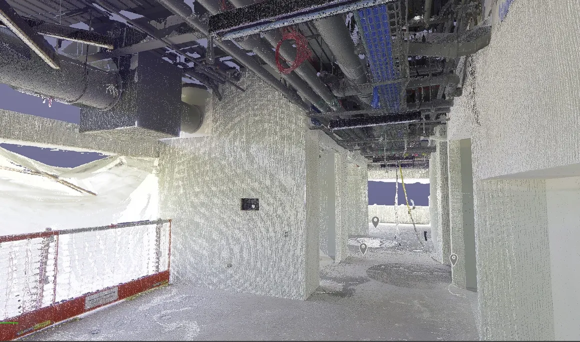
Using LiDAR (https://en.wikipedia.org/wiki/Lidar) to bring a schematic to life. By capturing millions of precise data points with laser pulses to create detailed 3D models of real-world environments. This technology scans spaces quickly and accurately, converting them into comprehensive digital representations. These 3D models enable architects, designers, and engineers to visualize and manipulate schematics with high precision. Thus, ensuring every detail is accounted for. By integrating Lidar 3d Scanning into CAD software, professionals can overlay designs onto existing conditions. Making it easier to plan renovations, validate designs, and communicate ideas effectively. This process enhances accuracy, saves time, and brings schematics to vivid, actionable life.
Start here: https://precision3dscanning.com/request-a-quote/