Concrete Flattness and Level Testing
-
3D Scans and Construction, 3D Scans in Real Estate, As-Built Scans Denver, Concrete Elevation Heat Maps Denver, Concrete Flattness and Level Testing, Denver 3D Laser Scanning, LiDAR scanning Colorado, LiDAR scanning Denver, Point Cloud Mapping Denver
3D Scanning Services in Denver for Construction & Real Estate
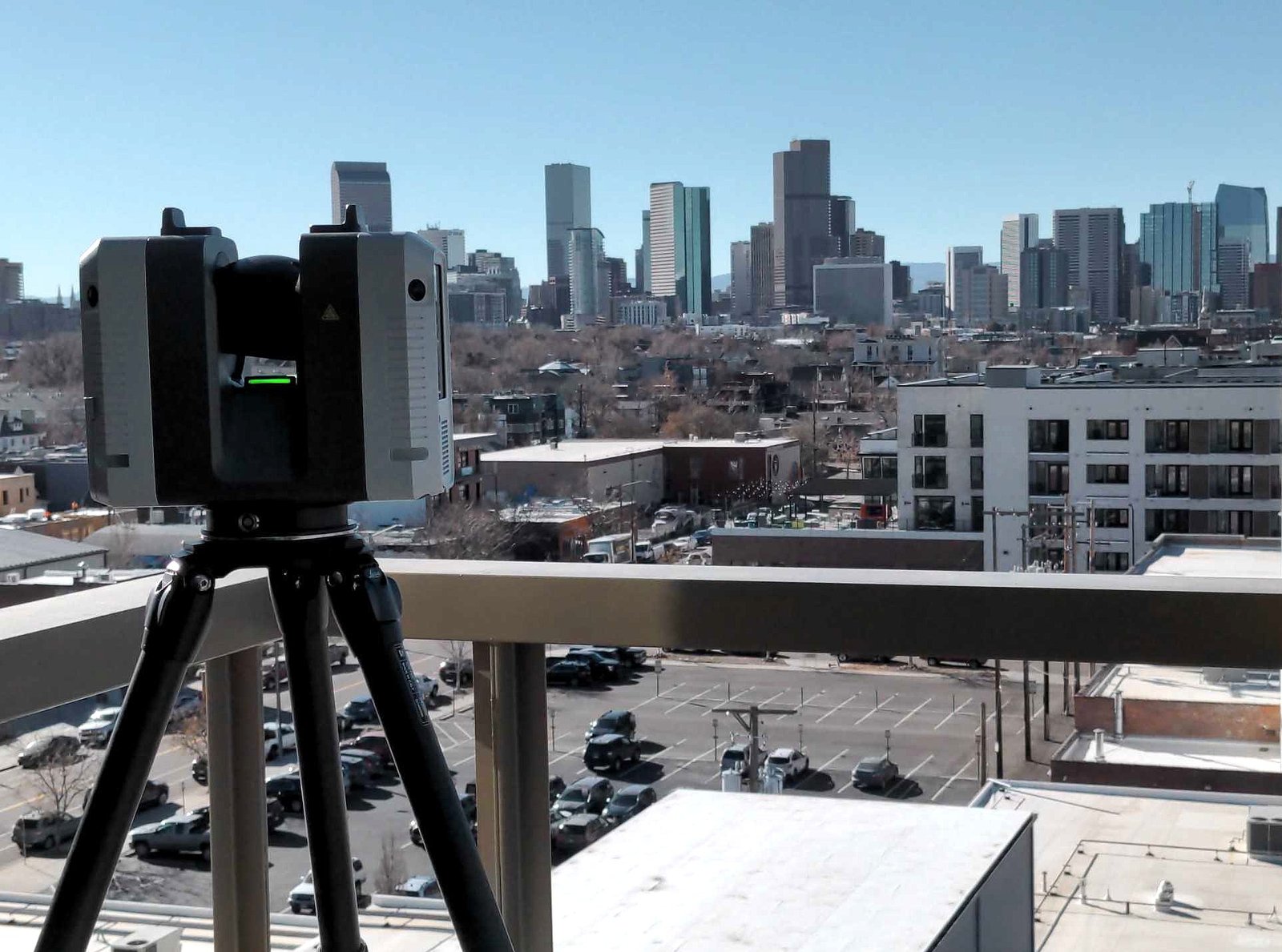
Precision 3D Scanning captured this photo of our LiDAR scanner overlooking downtown Denver. We use this scanner to deliver accurate floor plans, BIM models, square footage verification for realtors, and concrete elevation heat maps.
-
Concrete Flattness and Level Testing, Joe Trujillo Precision 3D Scanning, Laser Scanning for Floor Flatness, LiDAR scanning Denver, Lidar Scanning for Concrete Analysis, nationwide LiDAR scanning services, Point Cloud Surface Mapping
Using LiDAR Scanning for Concrete Surface Analysis: Ensuring Flatness and Level
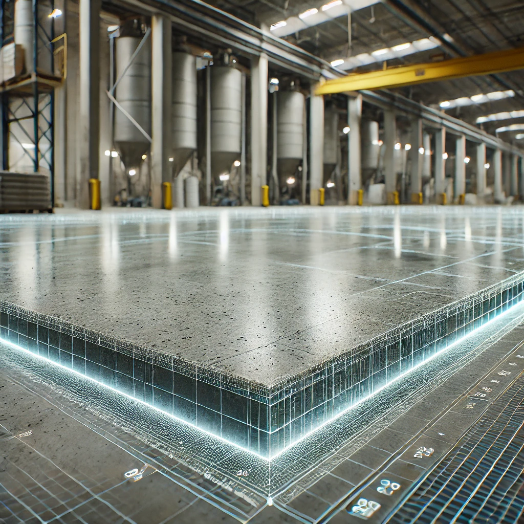
Using LiDAR Scanning for Concrete Surface Analysis FF/FL and concrete elevation heat maps
-
3D Scans and Construction, Concrete Flattness and Level Testing, FF / FL, Joe Trujillo Precision 3D Scanning, LiDAR scanning Colorado, LiDAR scanning Denver, Lidar Scanning for Concrete Analysis, Point Cloud
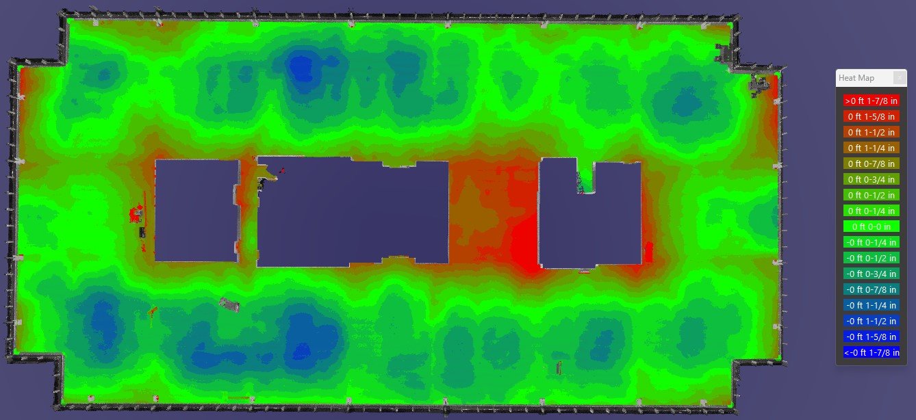
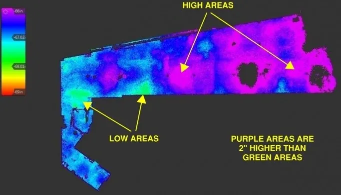
Stunning Concrete Elevation Heat Maps by Precision 3D Scanning

Concrete Elevation Heat Maps in action. Title: Unveiling the Beauty of Concrete Elevation Heat Maps: Precision 3D LiDAR Scanning In the dynamic world of architecture and construction, innovation meets precision through 3D LiDAR scanning. This groundbreaking technology unlocks a realm of possibilities, transforming mundane structures into visually breathtaking Concrete Elevation Heat Maps. Concrete elevation deviations…
-
3D Scans and Construction, Concrete Flattness and Level Testing, FF / FL, Joe Trujillo Precision 3D Scanning, LiDAR scanning Colorado, LiDAR scanning Denver, Lidar Scanning for Concrete Analysis
The Power of Concrete Elevational Heatmaps in Construction
By utilizing Lidar Technology, Precision 3D scanning is a leader in concrete elevational heatmaps in concrete finishes.
-
3D Scans and Construction, Concrete Elevation Heat Maps, Concrete Flattness and Level Testing, FF / FL, FF / FL concrete testing, Joe Trujillo Precision 3D Scanning, LiDAR scanning Colorado, LiDAR scanning Denver, nationwide LiDAR scanning services
Using LiDAR Scans to Address Surface Deficiencies to Achieve Project-Specific FF/FL
LiDAR Scans to Address Surface Deficiencies to Achieve Project-Specific FF/FL
-
3D Scans and Construction, Concrete Elevation Heat Maps, Concrete Flattness and Level Testing, FF / FL, Joe Trujillo Precision 3D Scanning, LiDAR scanning Colorado, LiDAR scanning Denver, Lidar Scanning for as Builts
3D Laser Scanning: Post-Tension Slabs Before and After Placement
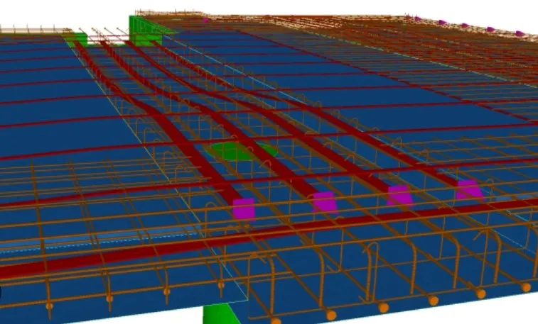
In the intricate world of construction, precision is paramount. Enter 3D laser scanning—a game-changing technology that is revolutionizing how we approach complex structural elements like post-tension slabs.3D LiDAR scanning of post-tension slabs transforms how teams capture detailed spatial data. This enables better understanding, planning, and verification both before and after concrete placement. In this article,…
-
3D Scans and Construction, Concrete Elevation Heat Maps, Concrete Flattness and Level Testing, FF / FL concrete testing, for Property Developers, Joe Trujillo Precision 3D Scanning, LiDAR scanning Colorado, LiDAR scanning Denver, nationwide LiDAR scanning services
Enhanced ADA Compliance in Construction Through 3D LiDAR Scanning

In the realm of construction, one fundamental principle stands above all: inclusivity. The Americans with Disabilities Act (ADA) was enacted to ensure that people with disabilities have equal access to public spaces, and it has profoundly impacted the construction industry. The integration of 3D LiDAR scanning technology has emerged as a game-changer, offering an Enhanced…
-
3D Scans and Construction, Concrete Elevation Heat Maps, Concrete Flattness and Level Testing, FF / FL, Joe Trujillo Precision 3D Scanning, LiDAR scanning Colorado, LiDAR scanning Denver
Unveiling 3D LiDAR Scanning: Enhancing FF/FL and Heatmaps
Unveiling 3D LiDAR Scanning: Enhancing FF/FL and Heatmaps
Revolutionizing the Construction Industry with Point Cloud 3D Scans