LiDAR scanning Denver
-
3D Scans and Construction, Joe Trujillo Precision 3D Scanning, LiDAR scanning Colorado, LiDAR scanning Denver
LiDAR vs Total Station: Understanding the Tools That Build and Verify the Modern Jobsite
LiDAR and total stations aren’t rivals—they’re complementary. Learn how both tools define accuracy and efficiency on Colorado jobsites with Precision 3D Scanning.
-
3D Scans and Construction, 3D Scans in Real Estate, for Architects, for Property Developers, Joe Trujillo Precision 3D Scanning, LiDAR scanning Colorado, LiDAR scanning Denver
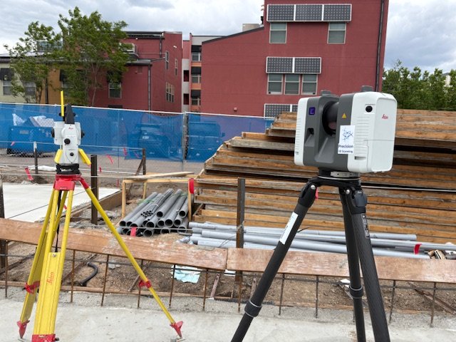
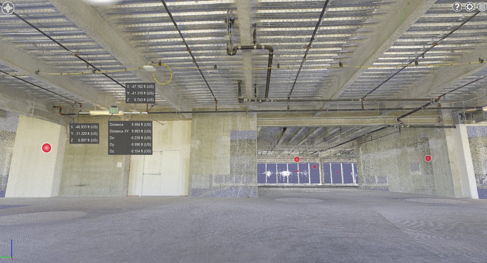
Precision 3D Scanning: When to Tie LiDAR Scans to Survey Control in Denver and Colorado Projects
On-site with the Leica RTC360 in Denver, Precision 3D Scanning ties LiDAR scans to survey control points for unmatched accuracy. This workflow ensures dependable as-builts, eliminates costly errors, and provides architects, engineers, and contractors with the verified data they need for successful construction projects
-
3D Scans and Construction, As-Built, As-Built Documentation, BIM Ready Models Colorado, for Architects, for Property Developers, for Property Owners, LiDAR scanning Colorado, LiDAR scanning Denver, Point Cloud to Revit, Scan to BIM Denver
From Scan to BIM: How LiDAR Scanning Creates Accurate Digital Models in Denver and Beyond
When architects, engineers, and contractors work from outdated drawings or incomplete site info, mistakes add up fast. Wrong dimensions, field rework, material waste, and blown schedules will ruin a project. That’s where Precision 3D Scanning steps in. Using our Leica RTC360 LiDAR scanner, we capture millions of measurement points in minutes, creating a precise point…
-
3D Scans and Construction, 3D Scans in Real Estate, As-Built Scans Denver, Concrete Elevation Heat Maps Denver, Concrete Flattness and Level Testing, Denver 3D Laser Scanning, LiDAR scanning Colorado, LiDAR scanning Denver, Point Cloud Mapping Denver
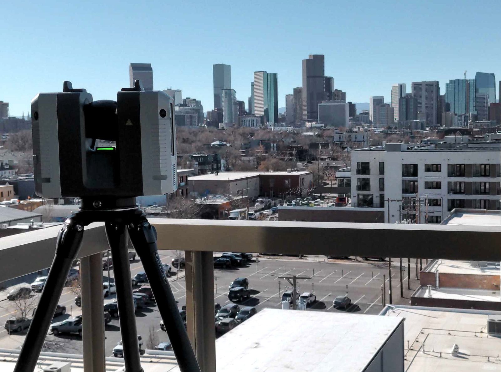
3D Scanning Services in Denver for Construction & Real Estate
Precision 3D Scanning captured this photo of our LiDAR scanner overlooking downtown Denver. We use this scanner to deliver accurate floor plans, BIM models, square footage verification for realtors, and concrete elevation heat maps.
-
3D scanning Colorado, architectural metalwork scanning, as-built 3D scanning, Joe Trujillo Precision 3D Scanning, LiDAR for metal fabrication, LiDAR scanning Colorado, LiDAR scanning Denver, nationwide LiDAR scanning services
LiDAR Scanning for Metal Fabrication in Denver: From Scan to Solid
Joe Trujillo of Precision 3D Scanning delivers accurate LiDAR scanning for metal fabrication projects in Denver and across the U.S. Using advanced technology like the Leica RTC360, we capture precise site data and convert it into fabrication-ready STP files. From curved staircases to complex architectural metalwork, our process ensures perfect fitment, reduced rework, and faster…
-
3D scanning Colorado, 3D Scans and Construction, As-Built, for Property Developers, Joe Trujillo Precision 3D Scanning, LiDAR scanning Denver, Precision 3D Scanning services
Why LiDAR Scanning Beats Photos for As-Built Documentation in New Construction
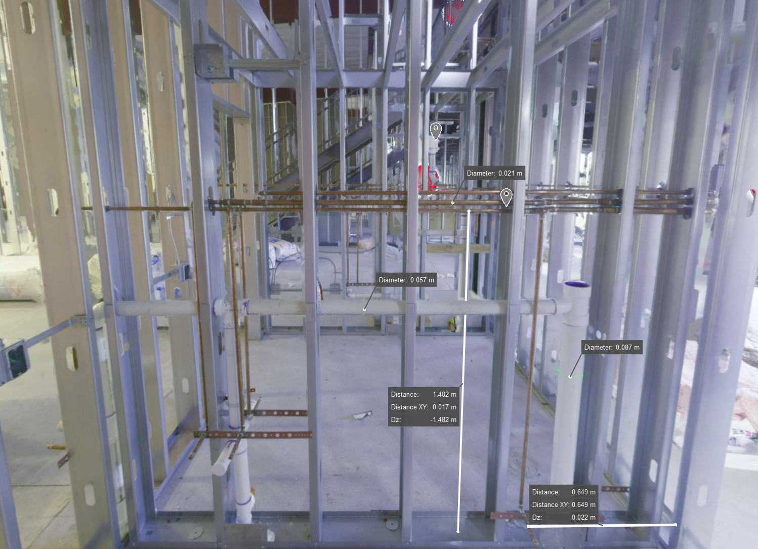
3D laser scanning image of a framed wall in new construction, showing exposed MEP systems for creating accurate digital as-builts before finishes are applied
-
3D scanning Denver, for Property Owners, Jobsite Safety, Joe Trujillo Precision 3D Scanning, LiDAR scanning Colorado, LiDAR scanning Denver
How LiDAR Scanning Enhances Jobsite Safety

The Challenge of Jobsite Safety Construction sites are unpredictable. They shift daily with equipment, people, and material in constant motion. In this environment, safety becomes a moving target. But with LiDAR, you gain the ability to see, plan, and react faster than ever. What LiDAR Does Differently LiDAR scanning captures millions of precise data points…
-
Historic Preservation, Joe Trujillo Precision 3D Scanning, LiDAR scanning Colorado, LiDAR scanning Denver, Lidar Scanning for Historic Preservation
Preserving Colorado’s Historical Sites with LiDAR Scanning
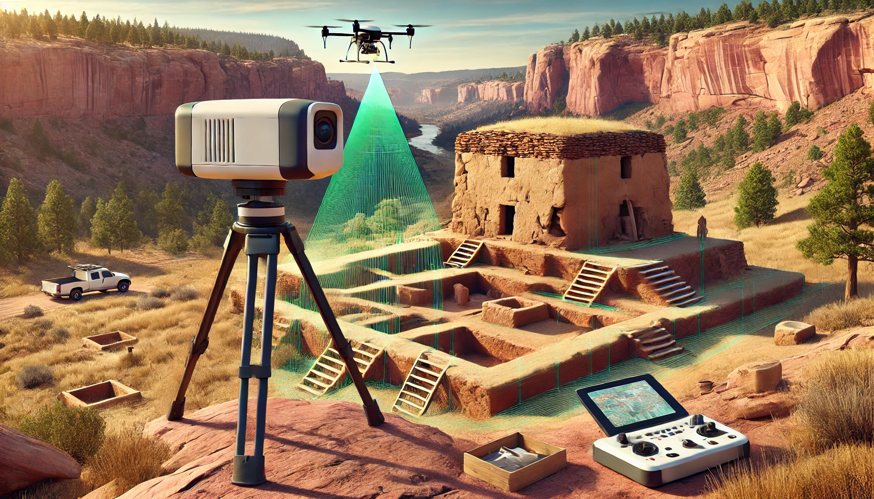
LiDAR Scan of Historical Preservation Site
-
3D Scans and Construction, 3D Scans in Real Estate, for Architects, Joe Trujillo Precision 3D Scanning, LiDAR scanning Colorado, LiDAR scanning Denver, nationwide LiDAR scanning services
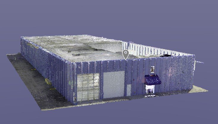
Case Study: Modernizing 6245 Garrison Street with LiDAR Technology
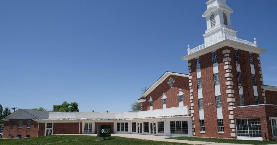
Background The Mile High Vineyard Church in Arvada, Colorado, recently began an exciting project: renovating their new building at 6245 Garrison Street. This property, with its 34,000 square feet spread across three levels and a historic belltower, held a lot of potential—but also some big challenges. The biggest hurdle? They didn’t have any verified architectural…
-
3D Scans and Construction, Joe Trujillo Precision 3D Scanning, Lidar for Fire Protection, LiDAR scanning Colorado, LiDAR scanning Denver, Lidar Scanning for as Builts, nationwide LiDAR scanning services
How 3D LiDAR Scanning is Changing the Fire Protection Industry
Fire Sprinkler System Measurements using Point Cloud and 3D Lidar Scanning
-
3D Scans and Construction, for Architects, Joe Trujillo Precision 3D Scanning, LiDAR scanning Colorado, LiDAR scanning Denver, Renovations
Case Study: Revolutionizing Renovations at Colorado Springs Fire Department Station #25
Client: Mark Young ConstructionLocation: Colorado Springs, Colorado Mark Young Construction embarked on a significant renovation of the Colorado Springs Fire Department Station #25, only to face a critical challenge: the station’s garage had long struggled with persistent drainage issues. This problem disrupted daily operations and posed a serious obstacle to the project’s success. Before proceeding,…
-
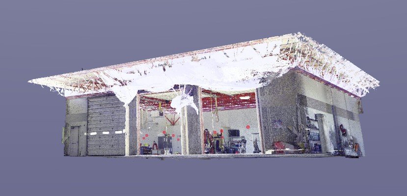
3D Scans and Construction, for Property Owners, Joe Trujillo Precision 3D Scanning, LiDAR scanning Colorado, LiDAR scanning Denver, Renovations
Case Study: Revitalizing a Mixed-Use Property with 3D LiDAR Scanning
3D Lidar Scan of Mixed use Warehouse provided by Precision 3D Scanning
-
3D Scans and Construction, Joe Trujillo Precision 3D Scanning, LiDAR scanning Colorado, LiDAR scanning Denver, Lidar Scanning for Historic Preservation, Renovations
Bringing History Back to Life: Restoring the 1892 Ochiltree Block Building
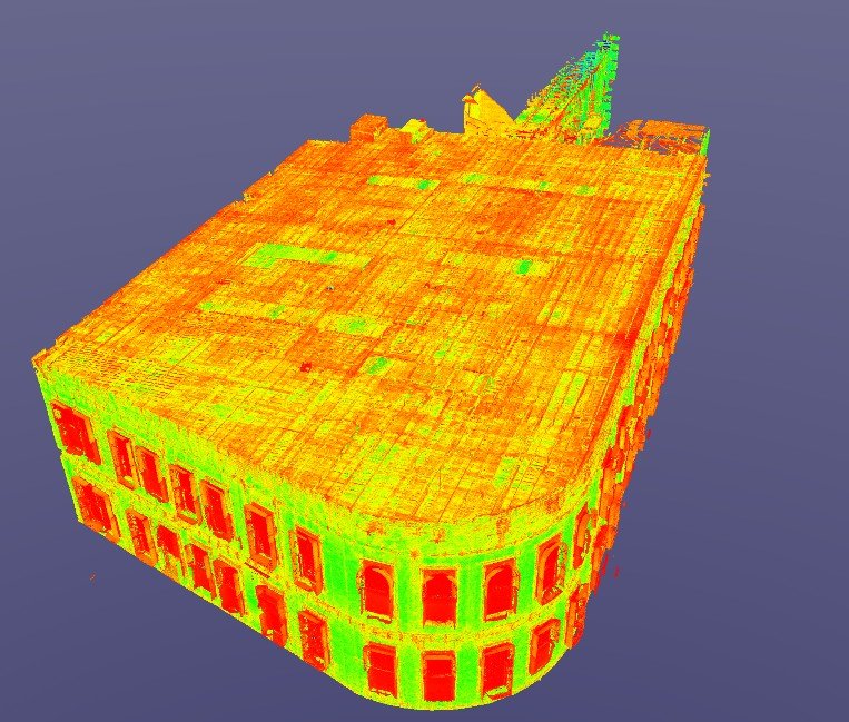
Nestled in Denver’s Highlands District, the Ochiltree Block building at 2935 Zuni stands as a monument to 19th-century architectural craftsmanship. Its rounded corner design, arched windows, and red brick façade have been a defining part of the neighborhood’s identity since 1892. However, decades of use and exposure to the elements left the building in need…
-
Concrete Flattness and Level Testing, Joe Trujillo Precision 3D Scanning, Laser Scanning for Floor Flatness, LiDAR scanning Denver, Lidar Scanning for Concrete Analysis, nationwide LiDAR scanning services, Point Cloud Surface Mapping
Using LiDAR Scanning for Concrete Surface Analysis: Ensuring Flatness and Level
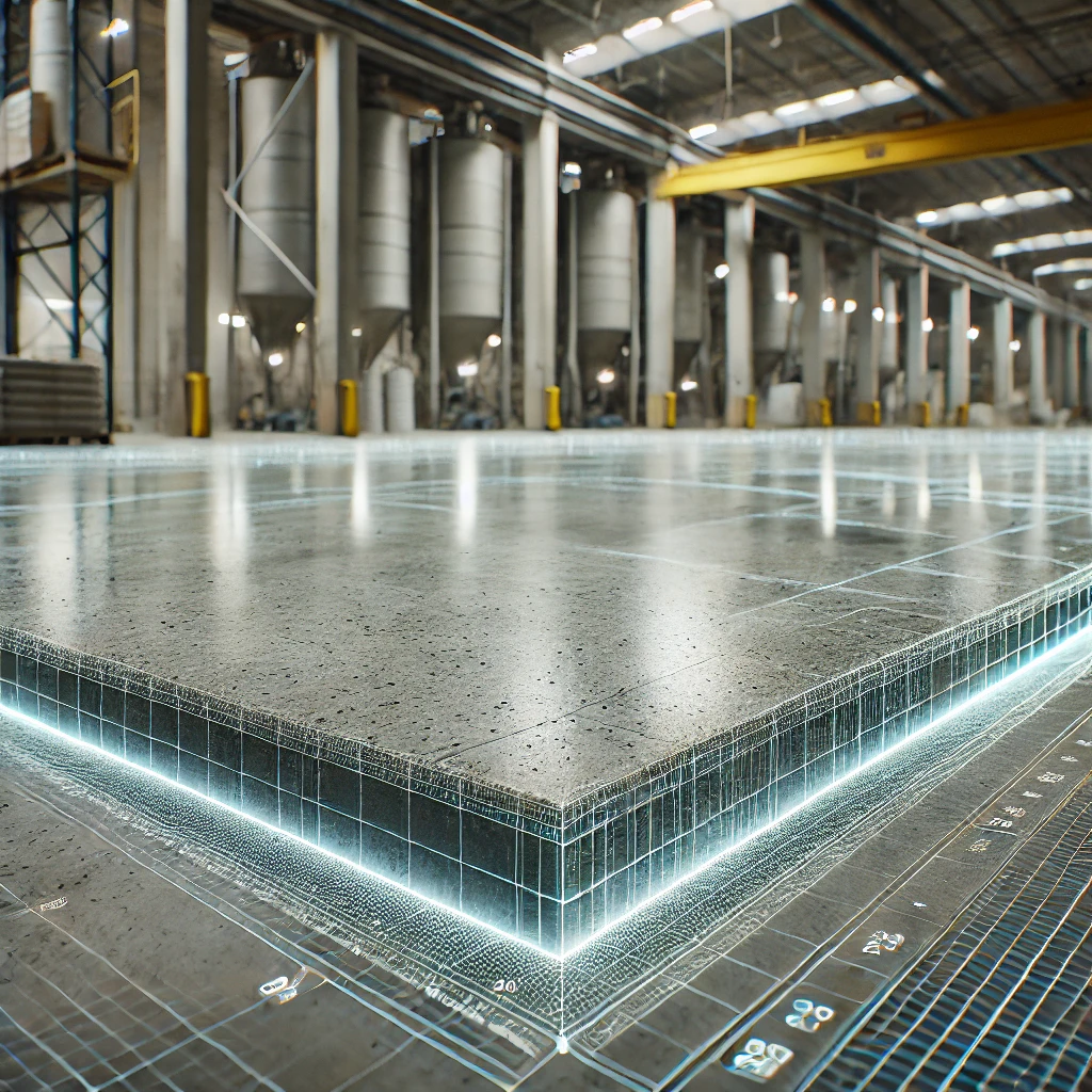
Using LiDAR Scanning for Concrete Surface Analysis FF/FL and concrete elevation heat maps
-
Joe Trujillo Precision 3D Scanning, LiDAR scanning Colorado, LiDAR scanning Denver, Lidar Scanning for Interior Design, nationwide LiDAR scanning services, Scanning for Interior Space Planning
Space Planning with 3D LiDAR Scanning
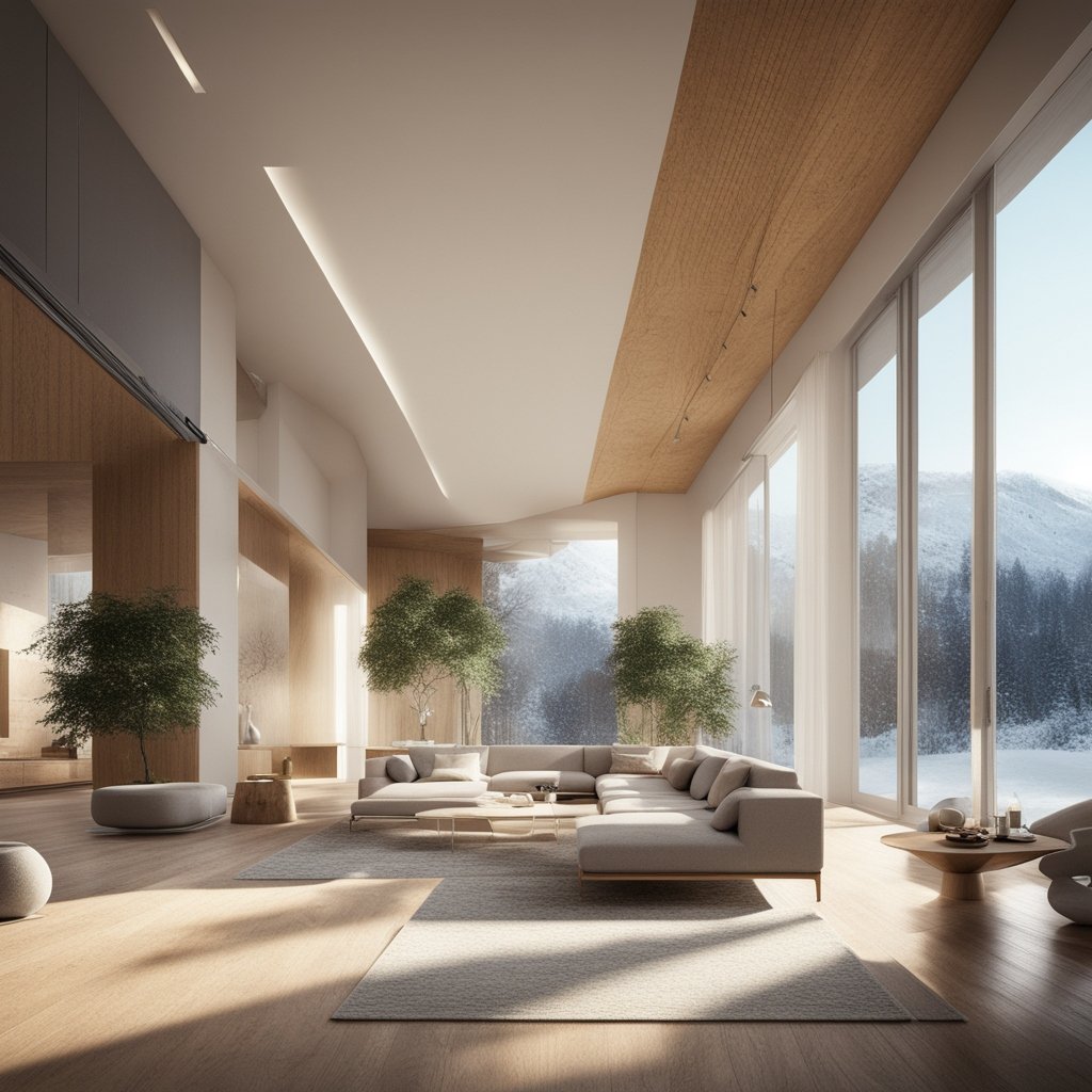
Space Planning with 3D LiDAR Scanning from Precision3dscanning.com
-
3D Scans and Construction, for Architects, Joe Trujillo Precision 3D Scanning, LiDAR scanning Colorado, LiDAR scanning Denver, Renovations
Transforming Hospital Renovations: The Role of 3D LiDAR Scanning in Coordination and Cost Reduction
Lidar scanning Hospital Renovations are complex undertakings that require meticulous planning, coordination, and execution. From accommodating evolving healthcare needs to complying with stringent regulatory requirements, every aspect of the renovation process demands careful attention. In this blog, we’ll explore how 3D LiDAR scanning technology is revolutionizing hospital renovations by facilitating coordination among architects, engineers, contractors,…
-
3D Scanning for Realtors, 3D Scans in Real Estate, Joe Trujillo Precision 3D Scanning, LiDAR scanning Colorado, LiDAR scanning Denver
Transforming Real Estate: 3D Point Clouds
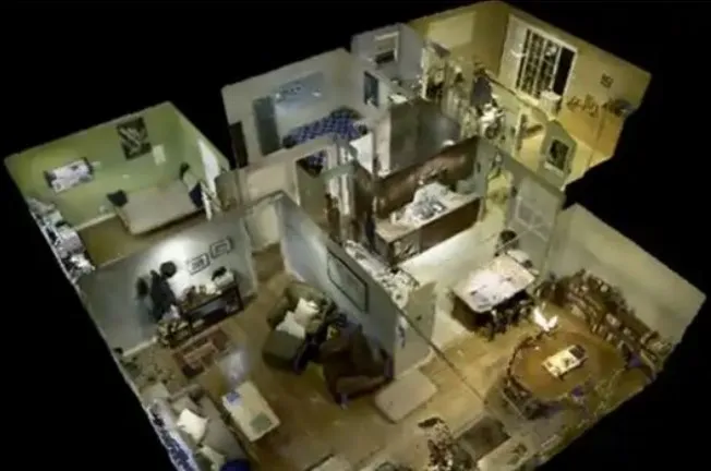
The real estate industry is no stranger to technological advancements. Now 3D point clouds have emerged as a powerful tool in reshaping the way properties are bought, sold, and managed. 3D point clouds, generated through 3D laser scanning and LiDAR technology, provide a detailed and accurate representation of properties. This is enabling real estate professionals…
-
3D Scans and Construction, for Architects, for Interior Design, for Property Owners, Joe Trujillo Precision 3D Scanning, LiDAR scanning Colorado, LiDAR scanning Denver
3D Lidar Scanning Brings AEC Together Like Never Before

One of the primary benefits of 3D LiDAR scanning is its ability to enhance collaboration among architects, engineers, contractors, and owners.
-
3D Scans and Construction, Concrete Flattness and Level Testing, FF / FL, Joe Trujillo Precision 3D Scanning, LiDAR scanning Colorado, LiDAR scanning Denver, Lidar Scanning for Concrete Analysis, Point Cloud
Stunning Concrete Elevation Heat Maps by Precision 3D Scanning

Concrete Elevation Heat Maps in action. Title: Unveiling the Beauty of Concrete Elevation Heat Maps: Precision 3D LiDAR Scanning In the dynamic world of architecture and construction, innovation meets precision through 3D LiDAR scanning. This groundbreaking technology unlocks a realm of possibilities, transforming mundane structures into visually breathtaking Concrete Elevation Heat Maps. Concrete elevation deviations…
-
3D Scans and Construction, Joe Trujillo Precision 3D Scanning, LiDAR scanning Colorado, LiDAR scanning Denver, nationwide LiDAR scanning services, Point Cloud
QA/QC During the Registration Phase Is a Critical Services in Action at Precision 3D Scanning
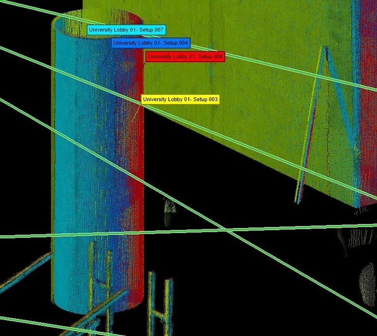
QA/QC at Registration Phase Is a Critical Services in Action
Revolutionizing the Construction Industry with Point Cloud 3D Scans