nationwide LiDAR scanning services
-
3D scanning Colorado, architectural metalwork scanning, as-built 3D scanning, Joe Trujillo Precision 3D Scanning, LiDAR for metal fabrication, LiDAR scanning Colorado, LiDAR scanning Denver, nationwide LiDAR scanning services
LiDAR Scanning for Metal Fabrication in Denver: From Scan to Solid
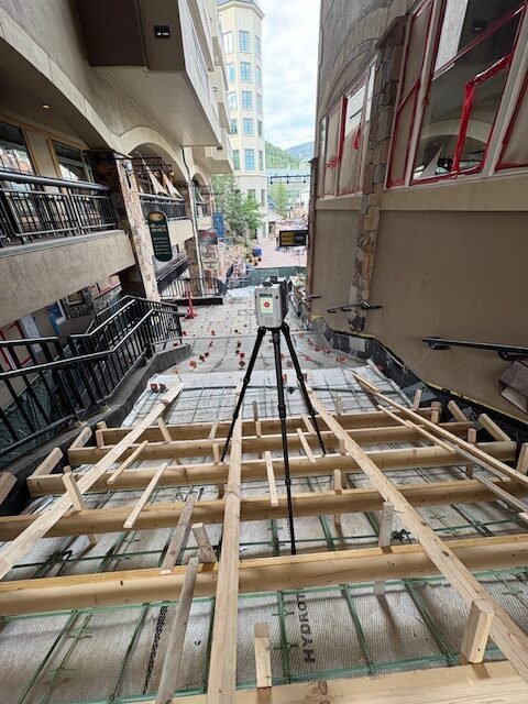
Joe Trujillo of Precision 3D Scanning delivers accurate LiDAR scanning for metal fabrication projects in Denver and across the U.S. Using advanced technology like the Leica RTC360, we capture precise site data and convert it into fabrication-ready STP files. From curved staircases to complex architectural metalwork, our process ensures perfect fitment, reduced rework, and faster…
-
Historic Preservation, Joe Trujillo Precision 3D Scanning, Lidar Scanning for Historic Preservation, nationwide LiDAR scanning services
A Lesson in Legacy: What a Vacation Stop at a Louis Sullivan Bank Taught Me About Preservation and Purpose

It wasn’t planned. I was in Owatonna, Minnesota on vacation with my family, eating truffles inside a 100-year-old chocolate shop. The floor was a classic 1×1 white hex tile with delicate black flower inlays—the kind of flooring that knows its history. But it wasn’t the shop that stole my attention. It was the view out…
-
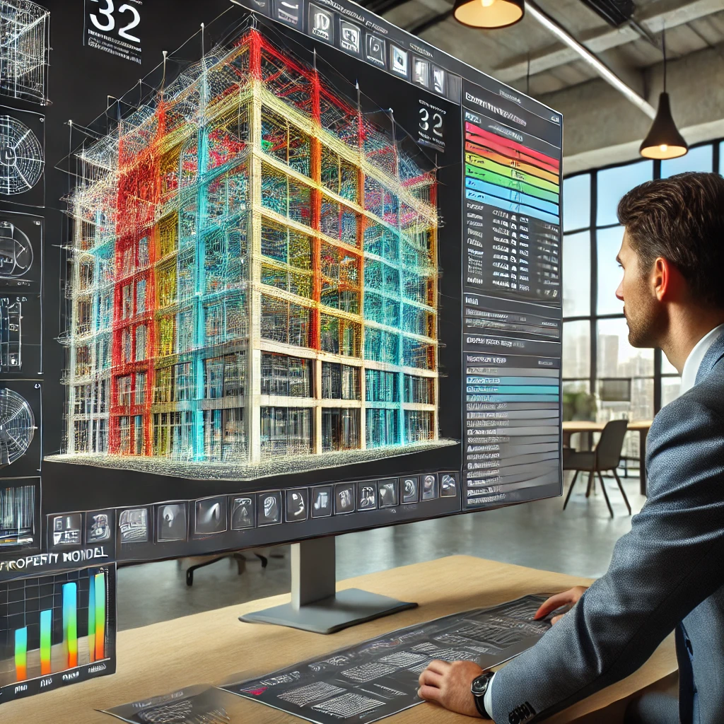
3D Scans and Construction, for Architects, Joe Trujillo Precision 3D Scanning, Lidar Scanning, nationwide LiDAR scanning services, Scan-to-BIM
Scan-to-BIM in Today’s World

Denver Scan-to-BIM Project
-
3D Scans and Construction, 3D Scans in Real Estate, for Architects, Joe Trujillo Precision 3D Scanning, LiDAR scanning Colorado, LiDAR scanning Denver, nationwide LiDAR scanning services
Case Study: Modernizing 6245 Garrison Street with LiDAR Technology
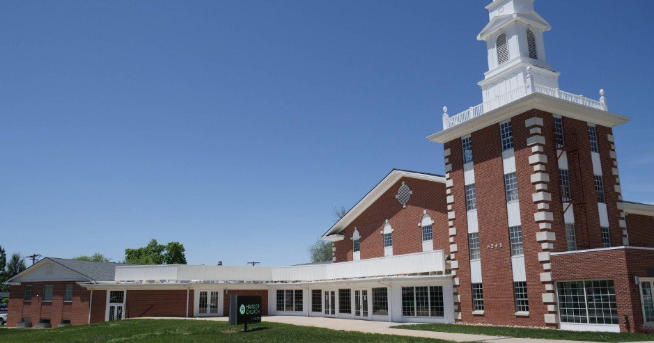
Background The Mile High Vineyard Church in Arvada, Colorado, recently began an exciting project: renovating their new building at 6245 Garrison Street. This property, with its 34,000 square feet spread across three levels and a historic belltower, held a lot of potential—but also some big challenges. The biggest hurdle? They didn’t have any verified architectural…
-
3D Scans and Construction, Joe Trujillo Precision 3D Scanning, Lidar for Fire Protection, LiDAR scanning Colorado, LiDAR scanning Denver, Lidar Scanning for as Builts, nationwide LiDAR scanning services
How 3D LiDAR Scanning is Changing the Fire Protection Industry
Fire Sprinkler System Measurements using Point Cloud and 3D Lidar Scanning
-
3D Scans and Construction, for Architects, Joe Trujillo Precision 3D Scanning, Lidar Scanning for Historic Preservation, nationwide LiDAR scanning services, Point Cloud, Renovations
Uncovering Hidden Issues: How LiDAR 3D Scanning Pinpoints Structural Deformities in Historical Building Renovations
LiDAR 3D Scanning Historical Building Renovations Renovating a historical building into modern apartments poses unique challenges. These projects blend the preservation of cultural heritage with the demands of modern design. Over time, buildings develop structural deformities due to settling, wear, and unplanned modifications, often concealed beneath their charming facades. Architects, engineers, and developers now rely…
-
Concrete Flattness and Level Testing, Joe Trujillo Precision 3D Scanning, Laser Scanning for Floor Flatness, LiDAR scanning Denver, Lidar Scanning for Concrete Analysis, nationwide LiDAR scanning services, Point Cloud Surface Mapping
Using LiDAR Scanning for Concrete Surface Analysis: Ensuring Flatness and Level
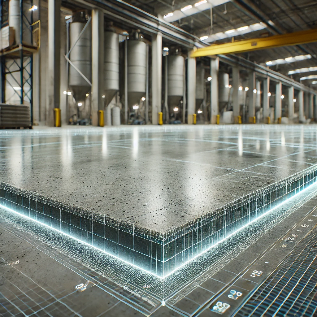
Using LiDAR Scanning for Concrete Surface Analysis FF/FL and concrete elevation heat maps
-
3D LiDAR Scanning for Property Management, 3D Scans in Real Estate, for Property Developers, for Property Owners, Joe Trujillo Precision 3D Scanning, nationwide LiDAR scanning services, precision 3D scanning Colorado, Remote Facility Management Tools
Enhancing Portfolio Management with Point Clouds
Today, property owners and managers are increasingly turning to point clouds to streamline and enhance their portfolio management practices. Enhancing Portfolio Management with Point Clouds
-
3D Scanning for Architects and Designers, for Interior Design, for Property Owners, Kitchen Remodel Planning with Point Clouds, nationwide LiDAR scanning services, Point Clouds for Renovations, precision 3D scanning Colorado
Point clouds are reshaping kitchen renovations
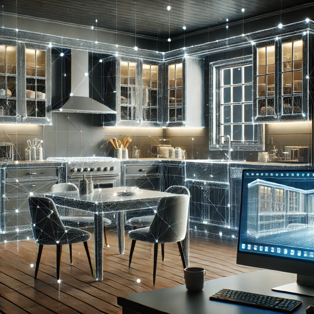
The Benefits of Point Clouds for Kitchen Renovations: A Guide for Interior Designers and Architects As an interior designer or architect, you understand the importance of precision in every project, especially in kitchen renovations where functionality meets aesthetics. Point clouds are reshaping kitchen renovations. The kitchen is one of the most complex spaces to design,…
-
Joe Trujillo Precision 3D Scanning, Lidar Scanning, Lidar Scanning for Historic Preservation, nationwide LiDAR scanning services, Renovations
How 3D LiDAR Scanning and Point Clouds are Preserving History

How 3D LiDAR Scanning and Point Clouds are Preserving History
-
3D Scans and Construction, for Property Developers, for Property Owners, Joe Trujillo Precision 3D Scanning, nationwide LiDAR scanning services
How Point Clouds Reduce Carbon Emission

As the world grapples with the growing urgency to combat climate change, architects and designers are increasingly focusing on sustainable practices. In construction and urban planning, reducing carbon emissions is a top priority. One of the cutting-edge technologies revolutionizing these fields is the use of point clouds.
-
Joe Trujillo Precision 3D Scanning, LiDAR scanning Colorado, LiDAR scanning Denver, Lidar Scanning for Interior Design, nationwide LiDAR scanning services, Scanning for Interior Space Planning
Space Planning with 3D LiDAR Scanning
Space Planning with 3D LiDAR Scanning from Precision3dscanning.com
-
3D Scans and Construction, Joe Trujillo Precision 3D Scanning, LiDAR scanning Colorado, LiDAR scanning Denver, nationwide LiDAR scanning services, Point Cloud
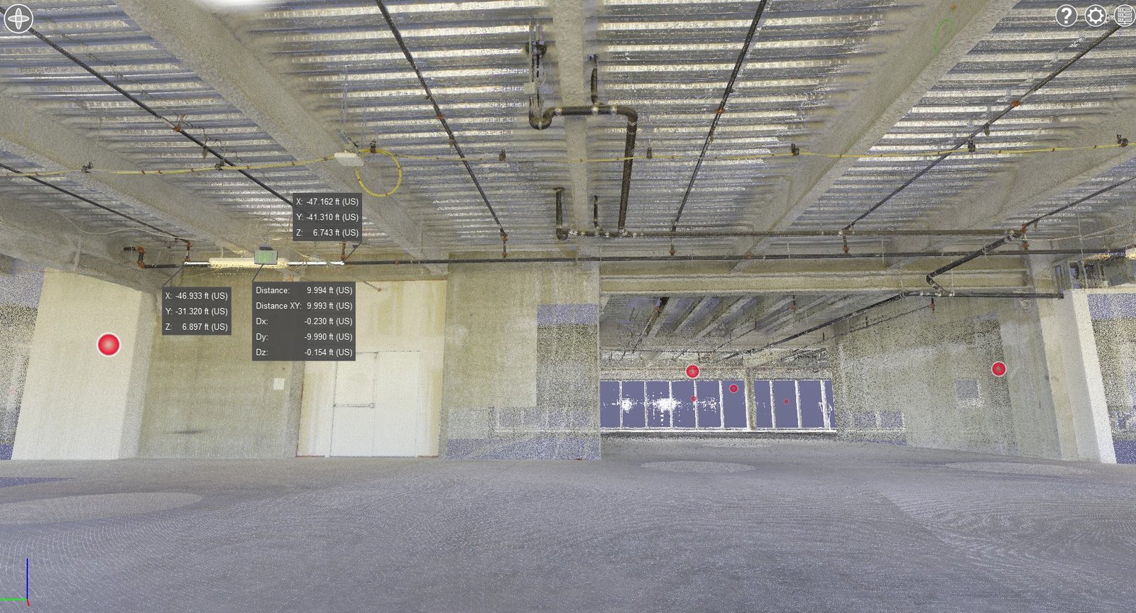
QA/QC During the Registration Phase Is a Critical Services in Action at Precision 3D Scanning
QA/QC at Registration Phase Is a Critical Services in Action
-
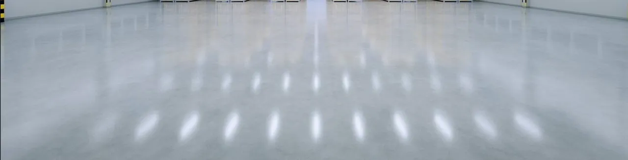
3D Scans and Construction, FF / FL, Joe Trujillo Precision 3D Scanning, LiDAR scanning Colorado, LiDAR scanning Denver, Lidar Scanning for Concrete Analysis, nationwide LiDAR scanning services
3D Scanning to Point Cloud
Use our construction service to go from plan to a 360 degree HDR Photo that you can measure. Point cloud creation with 3D scanning in the format of your choice to detailed reports such as a FF/FL Heat map of your project. Take virtual fly-through of your work in place. Point cloud creation with 3D…
-
for Interior Design, for Property Owners, Joe Trujillo Precision 3D Scanning, LiDAR scanning Colorado, LiDAR scanning Denver, Lidar Scanning for Interior Design, LiDAR Scanning for Property Owners, nationwide LiDAR scanning services
Residential Hallway Fly Through
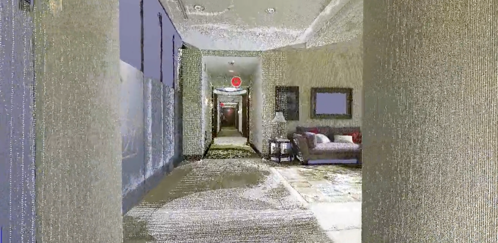
See how pinpoint accurate measurement can be taken once the point cloud laser mapping is created with LiDAR 3D scanning.
-
3D Scans and Construction, Joe Trujillo Precision 3D Scanning, LiDAR scanning Colorado, LiDAR scanning Denver, nationwide LiDAR scanning services
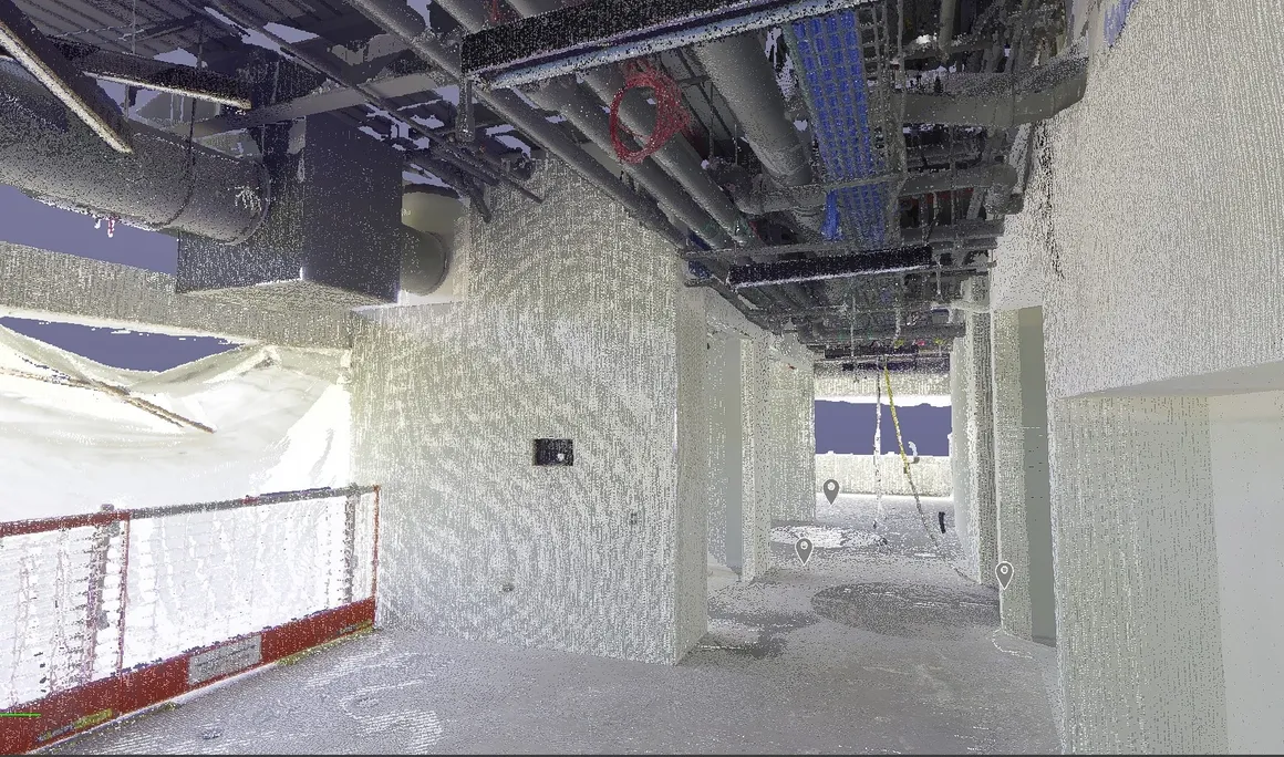
Precision 3D Scanning construction services Field Measure Point Cloud

Here we have a video flythrough that immerses you in a detailed digital world. This video isn’t just a visual tour; it’s a transformative experience that converts into a precise point cloud. As you navigate through the space, advanced LiDAR technology captures every detail with laser pulses. Once the flythrough ends, the captured data processes…
-
3D Scans in Real Estate, for Property Owners, Joe Trujillo Precision 3D Scanning, LiDAR scanning Colorado, LiDAR scanning Denver, nationwide LiDAR scanning services
3D Insurance Scanning with LiDAR | Protect Your Home & Property

Learn how 3D LiDAR scanning helps homeowners document property conditions for insurance claims, providing proof of value and protection against loss
-
3D Scans and Construction, for Interior Design, for Property Developers, Joe Trujillo Precision 3D Scanning, LiDAR scanning Colorado, LiDAR scanning Denver, nationwide LiDAR scanning services
Leveraging 3D LiDAR Scanning for Winning Renovation Bids

Leveraging 3D LiDAR Scanning for Winning Renovation Bids
-
3D Scans and Construction, Joe Trujillo Precision 3D Scanning, LiDAR scanning Colorado, LiDAR scanning Denver, Lidar Scanning for as Builts, nationwide LiDAR scanning services
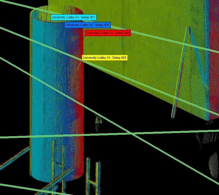
Enhancing Construction with LiDAR: Elevator & Stairwell Scanning
LiDAR Scanning in Elevator Shaft and Stairwell Fabrication
-
3D Scans and Construction, Concrete Elevation Heat Maps, Concrete Flattness and Level Testing, FF / FL, FF / FL concrete testing, Joe Trujillo Precision 3D Scanning, LiDAR scanning Colorado, LiDAR scanning Denver, nationwide LiDAR scanning services
Using LiDAR Scans to Address Surface Deficiencies to Achieve Project-Specific FF/FL
LiDAR Scans to Address Surface Deficiencies to Achieve Project-Specific FF/FL
Revolutionizing the Construction Industry with Point Cloud 3D Scans