As-Builts
-
3D Scans in Real Estate, As-Built Documentation, for Property Developers, for Property Owners, Joe Trujillo Precision 3D Scanning, LiDAR scanning Colorado
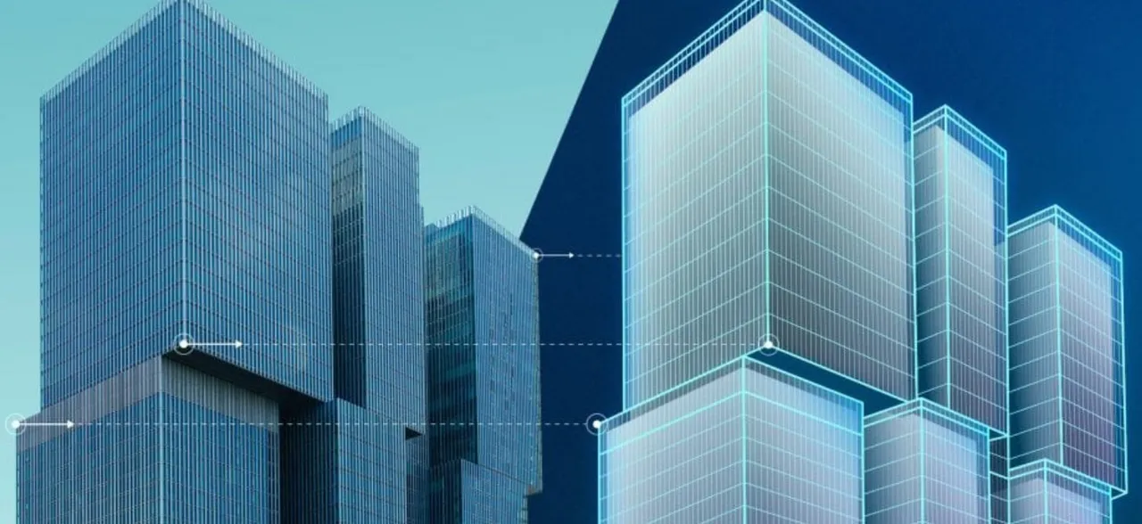
LiDAR Scanning in Urban Development: Protecting Developers From Hidden Risks
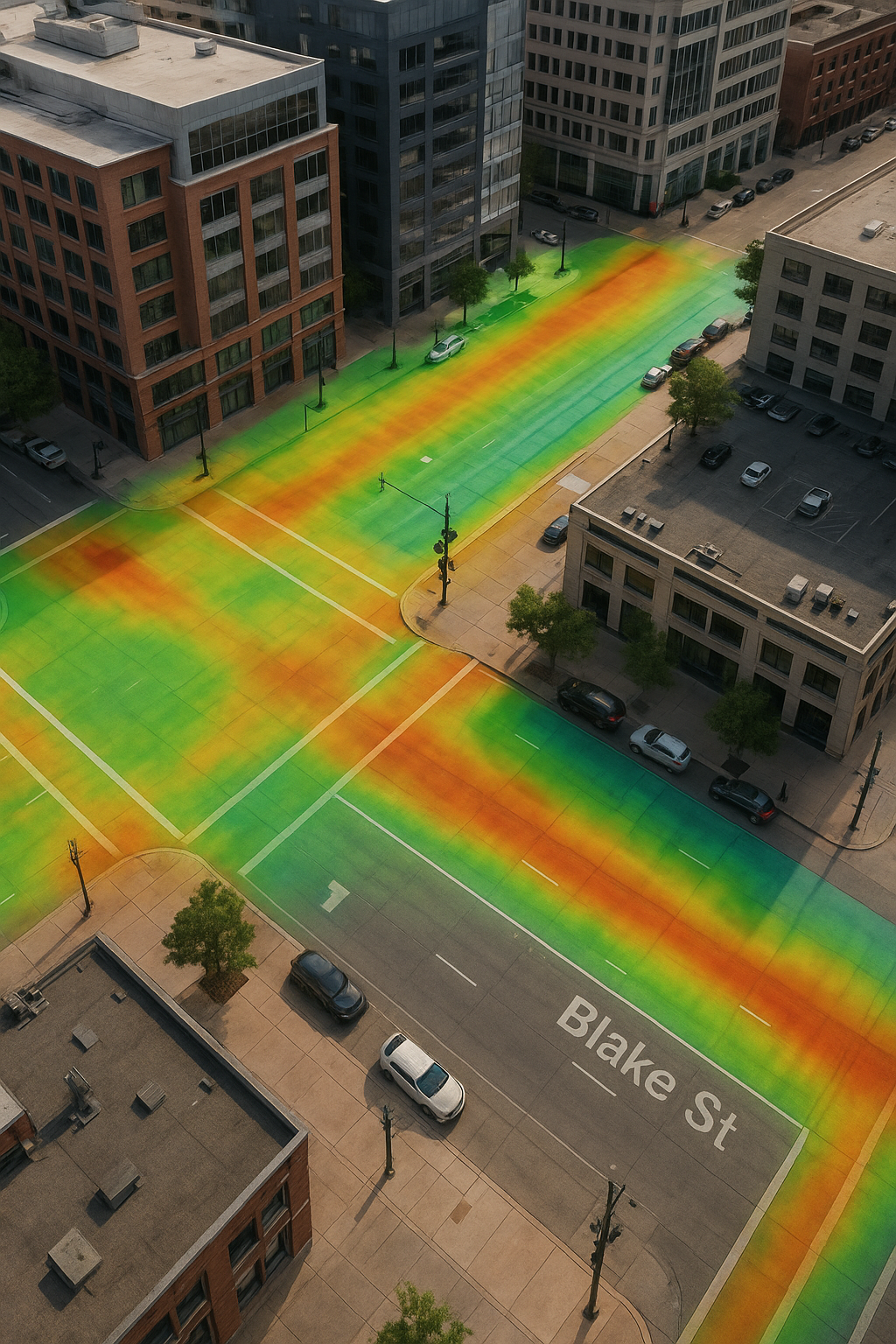
A detailed curb and gutter section with storm drain, overlaid with a vibrant LiDAR elevation heatmap. The color gradient highlights changes in elevation along the road and sidewalk, demonstrating how LiDAR scanning helps developers analyze drainage flow and protect urban projects from future infrastructure risks.
-
3D Scans and Construction, As-Built, As-Built Documentation, BIM Ready Models Colorado, for Architects, for Property Developers, for Property Owners, LiDAR scanning Colorado, LiDAR scanning Denver, Point Cloud to Revit, Scan to BIM Denver
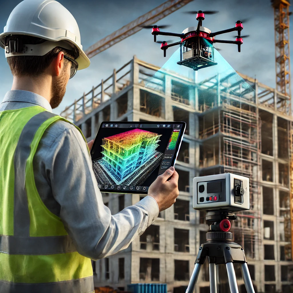
From Scan to BIM: How LiDAR Scanning Creates Accurate Digital Models in Denver and Beyond
When architects, engineers, and contractors work from outdated drawings or incomplete site info, mistakes add up fast. Wrong dimensions, field rework, material waste, and blown schedules will ruin a project. That’s where Precision 3D Scanning steps in. Using our Leica RTC360 LiDAR scanner, we capture millions of measurement points in minutes, creating a precise point…
-
3D Scans and Construction, 3D Scans in Real Estate, As-Built Scans Denver, Concrete Elevation Heat Maps Denver, Concrete Flattness and Level Testing, Denver 3D Laser Scanning, LiDAR scanning Colorado, LiDAR scanning Denver, Point Cloud Mapping Denver
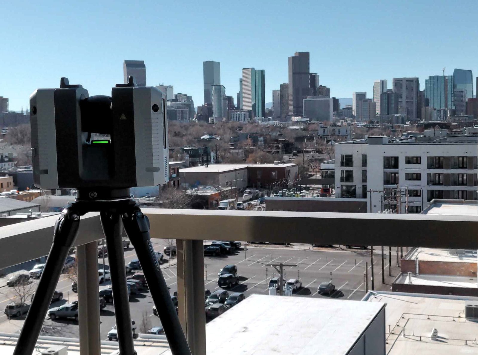
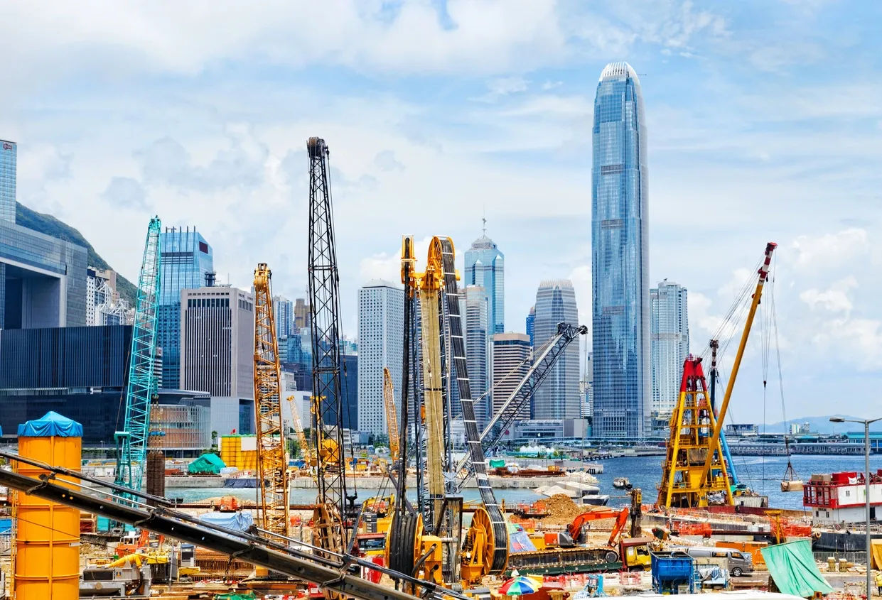
3D Scanning Services in Denver for Construction & Real Estate
Precision 3D Scanning captured this photo of our LiDAR scanner overlooking downtown Denver. We use this scanner to deliver accurate floor plans, BIM models, square footage verification for realtors, and concrete elevation heat maps.
-
3D scanning Colorado, architectural metalwork scanning, as-built 3D scanning, Joe Trujillo Precision 3D Scanning, LiDAR for metal fabrication, LiDAR scanning Colorado, LiDAR scanning Denver, nationwide LiDAR scanning services
LiDAR Scanning for Metal Fabrication in Denver: From Scan to Solid
Joe Trujillo of Precision 3D Scanning delivers accurate LiDAR scanning for metal fabrication projects in Denver and across the U.S. Using advanced technology like the Leica RTC360, we capture precise site data and convert it into fabrication-ready STP files. From curved staircases to complex architectural metalwork, our process ensures perfect fitment, reduced rework, and faster…
-
3D scanning Colorado, 3D Scans and Construction, As-Built, for Property Developers, Joe Trujillo Precision 3D Scanning, LiDAR scanning Denver, Precision 3D Scanning services
Why LiDAR Scanning Beats Photos for As-Built Documentation in New Construction
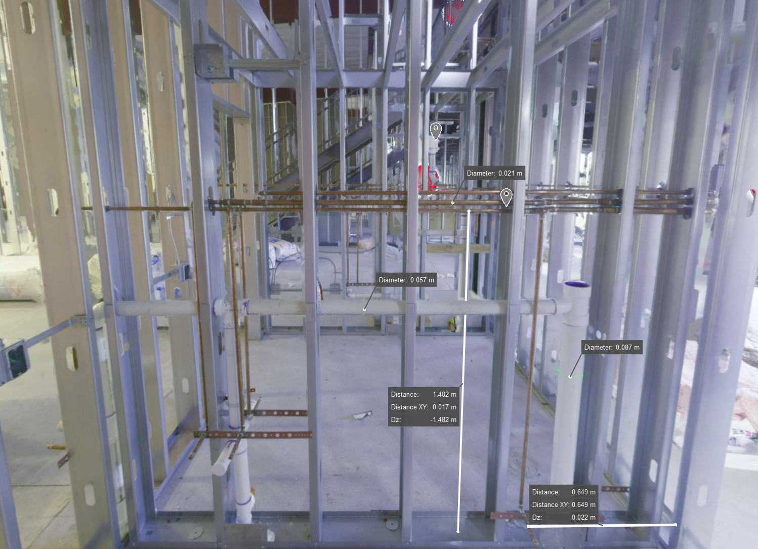
3D laser scanning image of a framed wall in new construction, showing exposed MEP systems for creating accurate digital as-builts before finishes are applied
-
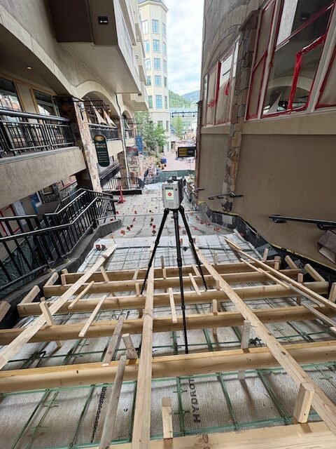
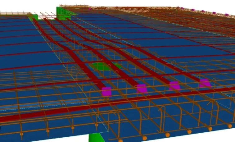
3D Scans and Construction, for Architects, Joe Trujillo Precision 3D Scanning, Lidar Scanning, nationwide LiDAR scanning services, Scan-to-BIM
Scan-to-BIM in Today’s World

Denver Scan-to-BIM Project
-
3D scanning Denver, 3D Scans and Construction, for Property Developers, for Property Owners, Joe Trujillo Precision 3D Scanning, LiDAR scanning Colorado, Scanning for QAQC
LiDAR Scanning For Third-Party Construction Inspections
Precision 3D Scanning performing 3rd party lidar scan for point cloud creation. Used in Revit and AutoCad.
-
3D Scans and Construction, for Property Owners, Joe Trujillo Precision 3D Scanning, LiDAR scanning Colorado, LiDAR scanning Denver, Renovations
Case Study: Revitalizing a Mixed-Use Property with 3D LiDAR Scanning
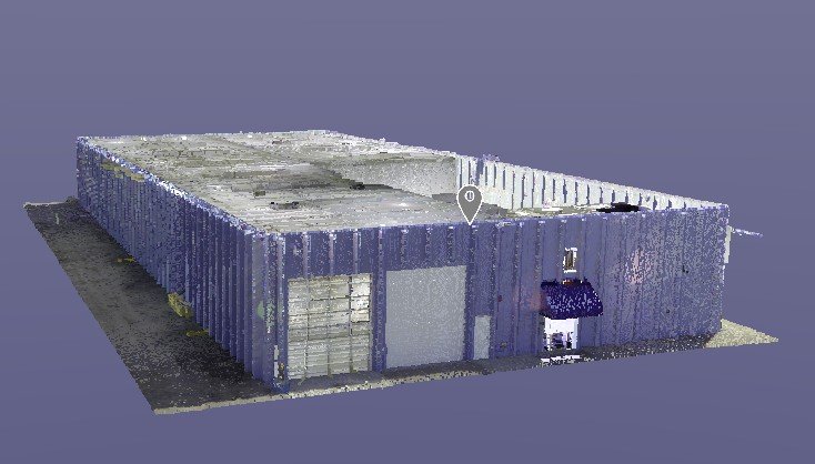
3D Lidar Scan of Mixed use Warehouse provided by Precision 3D Scanning
-
Concrete Flattness and Level Testing, Joe Trujillo Precision 3D Scanning, Laser Scanning for Floor Flatness, LiDAR scanning Denver, Lidar Scanning for Concrete Analysis, nationwide LiDAR scanning services, Point Cloud Surface Mapping
Using LiDAR Scanning for Concrete Surface Analysis: Ensuring Flatness and Level
Using LiDAR Scanning for Concrete Surface Analysis FF/FL and concrete elevation heat maps
-
3D Scans and Construction, Concrete Flattness and Level Testing, FF / FL, Joe Trujillo Precision 3D Scanning, LiDAR scanning Colorado, LiDAR scanning Denver, Lidar Scanning for Concrete Analysis, Point Cloud
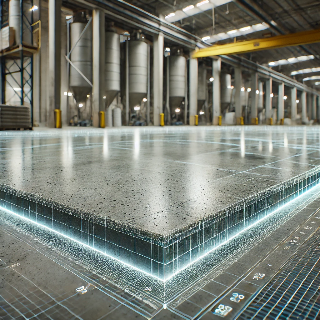
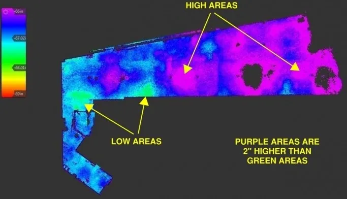
Stunning Concrete Elevation Heat Maps by Precision 3D Scanning

Concrete Elevation Heat Maps in action. Title: Unveiling the Beauty of Concrete Elevation Heat Maps: Precision 3D LiDAR Scanning In the dynamic world of architecture and construction, innovation meets precision through 3D LiDAR scanning. This groundbreaking technology unlocks a realm of possibilities, transforming mundane structures into visually breathtaking Concrete Elevation Heat Maps. Concrete elevation deviations…
-
3D Scans and Construction, FF / FL, Joe Trujillo Precision 3D Scanning, LiDAR scanning Colorado, LiDAR scanning Denver, Lidar Scanning for Concrete Analysis, nationwide LiDAR scanning services
3D Scanning to Point Cloud
Use our construction service to go from plan to a 360 degree HDR Photo that you can measure. Point cloud creation with 3D scanning in the format of your choice to detailed reports such as a FF/FL Heat map of your project. Take virtual fly-through of your work in place. Point cloud creation with 3D…
-
for Interior Design, for Property Owners, Joe Trujillo Precision 3D Scanning, LiDAR scanning Colorado, LiDAR scanning Denver, Lidar Scanning for Interior Design, LiDAR Scanning for Property Owners, nationwide LiDAR scanning services
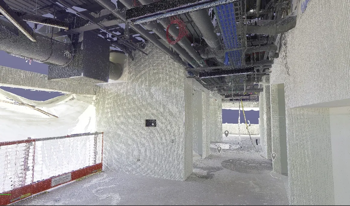
Residential Hallway Fly Through
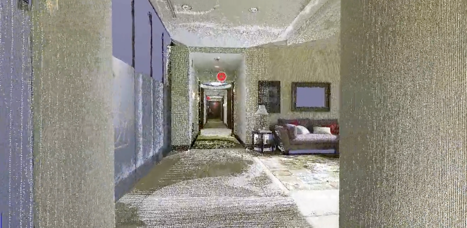
See how pinpoint accurate measurement can be taken once the point cloud laser mapping is created with LiDAR 3D scanning.
-
3D Scans and Construction, Joe Trujillo Precision 3D Scanning, LiDAR scanning Colorado, LiDAR scanning Denver, Lidar Scanning for as Builts, nationwide LiDAR scanning services
Enhancing Construction with LiDAR: Elevator & Stairwell Scanning
LiDAR Scanning in Elevator Shaft and Stairwell Fabrication
-
3D Scans and Construction, Concrete Elevation Heat Maps, Concrete Flattness and Level Testing, FF / FL, FF / FL concrete testing, Joe Trujillo Precision 3D Scanning, LiDAR scanning Colorado, LiDAR scanning Denver, nationwide LiDAR scanning services
Using LiDAR Scans to Address Surface Deficiencies to Achieve Project-Specific FF/FL
LiDAR Scans to Address Surface Deficiencies to Achieve Project-Specific FF/FL
-
3D Scans and Construction, Concrete Elevation Heat Maps, Concrete Flattness and Level Testing, FF / FL, Joe Trujillo Precision 3D Scanning, LiDAR scanning Colorado, LiDAR scanning Denver, Lidar Scanning for as Builts
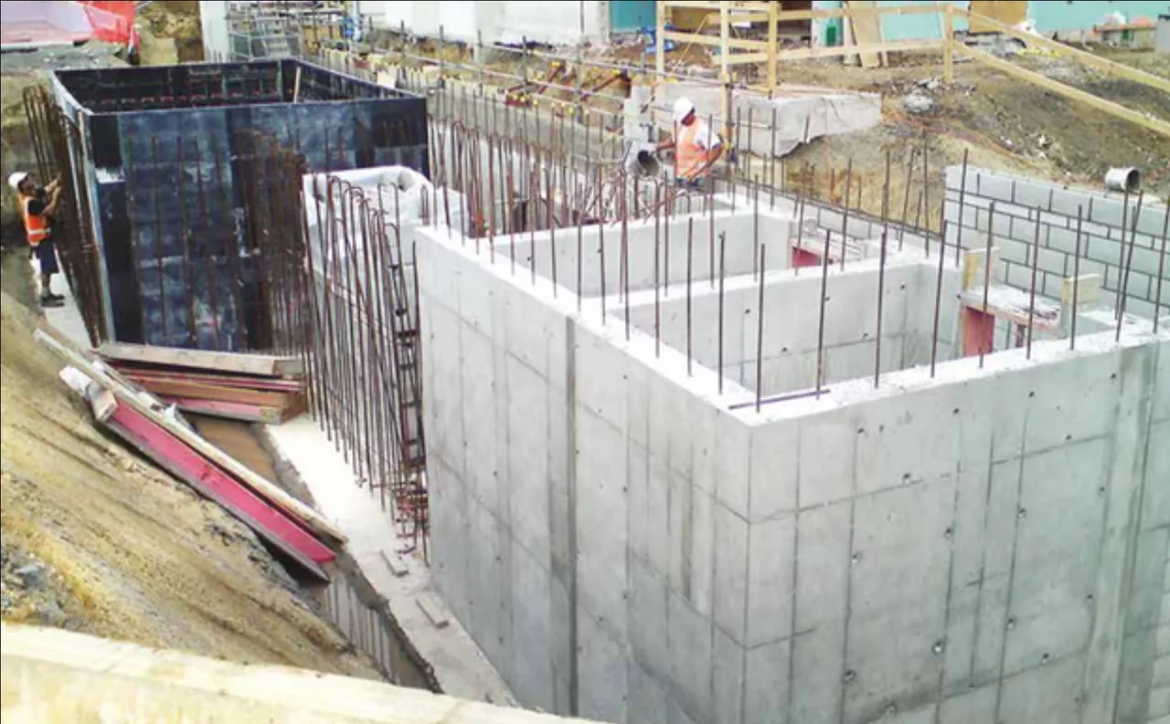
3D Laser Scanning: Post-Tension Slabs Before and After Placement
In the intricate world of construction, precision is paramount. Enter 3D laser scanning—a game-changing technology that is revolutionizing how we approach complex structural elements like post-tension slabs.3D LiDAR scanning of post-tension slabs transforms how teams capture detailed spatial data. This enables better understanding, planning, and verification both before and after concrete placement. In this article,…
-
3D Scans and Construction, Concrete Elevation Heat Maps, Concrete Flattness and Level Testing, FF / FL concrete testing, for Property Developers, Joe Trujillo Precision 3D Scanning, LiDAR scanning Colorado, LiDAR scanning Denver, nationwide LiDAR scanning services
Enhanced ADA Compliance in Construction Through 3D LiDAR Scanning

In the realm of construction, one fundamental principle stands above all: inclusivity. The Americans with Disabilities Act (ADA) was enacted to ensure that people with disabilities have equal access to public spaces, and it has profoundly impacted the construction industry. The integration of 3D LiDAR scanning technology has emerged as a game-changer, offering an Enhanced…
-
3D Scans in Real Estate, for Property Developers, for Property Owners, Joe Trujillo Precision 3D Scanning, LiDAR scanning Colorado, LiDAR scanning Denver, nationwide LiDAR scanning services
How 3D LiDAR Scanning and Digital Twins Empower Property Owners
Technology unlocks new dimensions of understanding and engagement. One such game-changer is the fusion of 3D LiDAR scanning and the creation of digital twins. These innovative technologies revolutionize the way property owners perceive, manage, and interact with their assets. In this blog, we delve into the remarkable benefits of 3D LiDAR scanning and digital twins,…
-
3D Scans and Construction, Joe Trujillo Precision 3D Scanning, LiDAR scanning Colorado, LiDAR scanning Denver
Unveiling the Power and limits of LiDAR Scanning in Construction
Unveiling the Power and limits of LiDAR Scanning in Construction
-
3D Scans and Construction, Concrete Elevation Heat Maps, Concrete Flattness and Level Testing, FF / FL, Joe Trujillo Precision 3D Scanning, LiDAR scanning Colorado, LiDAR scanning Denver
Unveiling 3D LiDAR Scanning: Enhancing FF/FL and Heatmaps
Unveiling 3D LiDAR Scanning: Enhancing FF/FL and Heatmaps
-
3D Scans and Construction, as-built 3D scanning, Joe Trujillo Precision 3D Scanning, LiDAR scanning Colorado, LiDAR scanning Denver, nationwide LiDAR scanning services
Bridging the Gap: How 3D Scanning Helps Catch Problems Early
Bridging the Gap: How 3D Scanning Helps Catch Problems Early
Revolutionizing the Construction Industry with Point Cloud 3D Scans